DOGIE TRAIL
Sycamore Canyon Wilderness
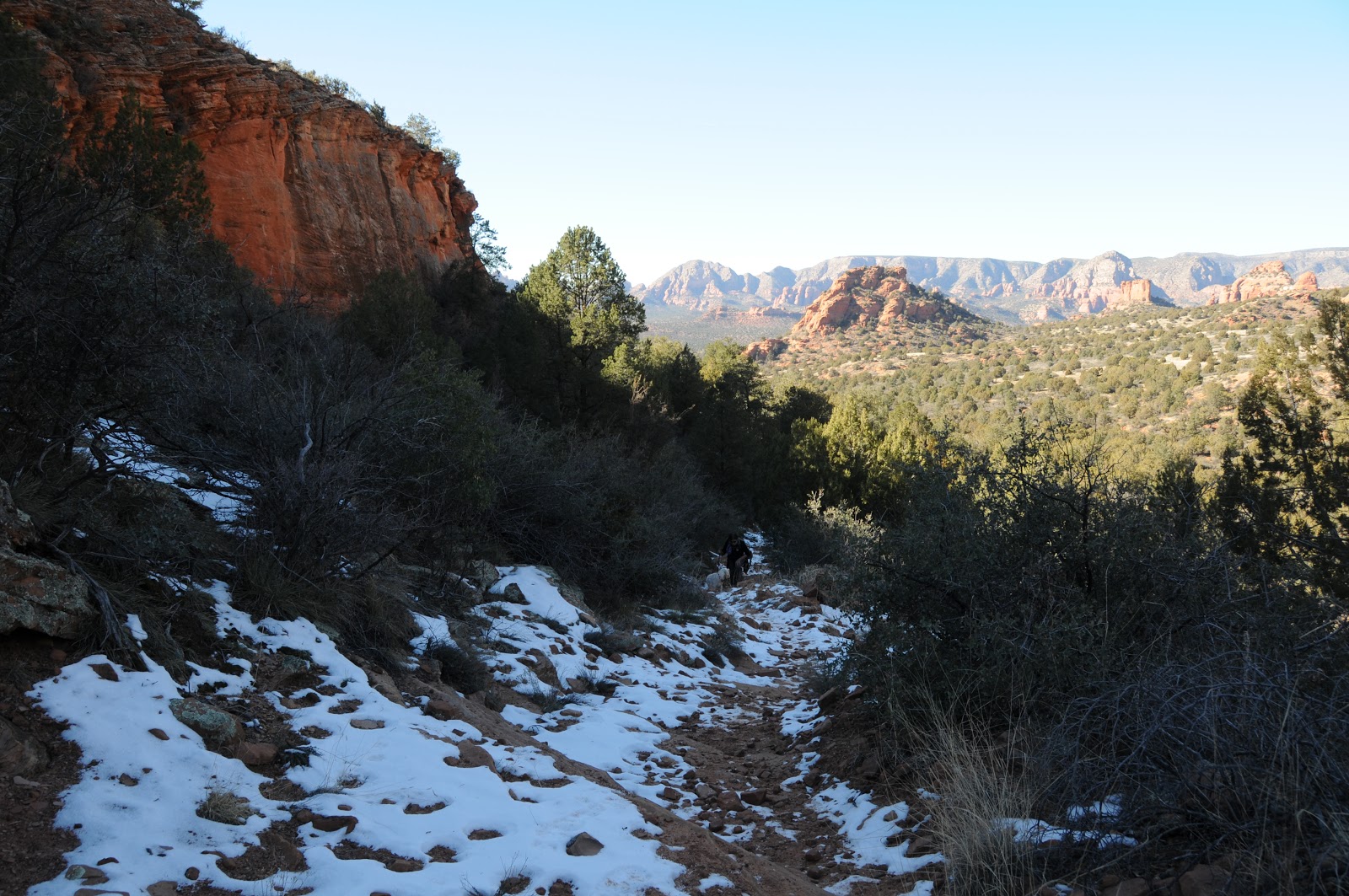 |
| Descent into Sycamore Canyon: Jan. 19, 2013 |

Big enough to awe but small enough to conquer, Arizona's
second largest canyon is no simpering runner-up. Whereas our #1 gorge, the Grand Canyon, is sculpted into
over a million acres of knotted cliffs and soft bends by Colorado River water,
its little sibbling looks like a 55,937-acre, rough-hacked slice of geological
layer cake. From it's head on the forested plateaus and prairies near Williams
to its spring-fed riparian oasis outlet in the Verde River Valley near
Cottonwood, the canyon's diverse terrain spans three national forests (Kaibab,
Prescott and Coconino) and two wilderness areas (Red Rock and Sycamore
Canyon). One of dozens of routes
leading into the wilderness, the Dogie Trail #116 accesses the canyon's
midsection in the heart of Sedona's red rock country and is a convienient entre
for backpackers setting out on the Taylor Cabin Loop circuit. For a location sandwiched less than 10
miles from two busy towns, the Dogie Trail exudes a primitive "out-there" kind of feel. The trail's geological confection is
one of blaze-red sedimentary sandstone and buff-colored limestone with a frosting
of inky-black, volcanic basalt.
Wind and water working over 290 million years have etched bizarre works
of art on the canyon walls while shaking loose a mixture of sand, marine fossils and chunks of glitzy
quartz which have spilled down
gullies to settle underfoot along
the route. The pinion pines, scrub
oaks and junipers bursting from the trail's ancient rock pediment offer little shade, which is why the best window of opportunity to
enjoy a nice cool outing here is from November through March. Temperatures
topped out in the high 50s when we hiked here this weekend, but it felt much
warmer. This repurposed cattle trail (a "dogie" is an orphaned
calf) is maintained in an
respectful, unobnoxious kind of way, which is to say that the path is clear but
not overworked and signs are posted only at important junctions to preserve the
wilderness experience. When used
for an out-and-back day trip, keep in mind that you'll be hiking down on the
way in and up on the way out and even though 400' of elevation change may not
sound like much, the constant dips and rises over loose-pebble ledges and rocky
creek beds will test your stamina more than expected.
 |
| Doggies on the Dogie Trail |
LENGTH: 5.4 miles one way
RATING:
moderate
ELEVATION: 4850' - 4450'
BEST SEASONS:
spring, fall, winter
FACILITIES: none
DISTANCE FROM PHOENIX: 117 miles one way
GETTING THERE:
From Phoenix, travel north on I17 to the McGuireville exit
293. Go left onto Cornville Road
and continue 13 miles to AZ89A.
Turn right and go 7 miles on
89A to FR 525 just past
milepost 364 on the left. Turn
left and go 2.8 miles on 525 to a fork in the road with a sign for
"Palatki", turn left here to get on FR525C---which is not signed. Continue 8 miles on FR525C, there are
many side roads but 525C is well
signed and dead ends at the trailhead. ROAD CONDITIONS: The access roads are good dirt with
just a few moderately rough spots and a short section of mountain grades. Although high-clearance is
preferable, carefully-driven passenger cars can get thru just fine. Call ahead, though,--the forest
service sometimes closes the access roads due to weather.
INFO:
Red Rock Ranger District, Coconino National Forest,
928-203-7500, 928-203-2900
MORE PHOTOS:
0 comments:
Post a Comment