SAN TAN TRAIL
San Tan Mountain Regional Park, Queen Creek
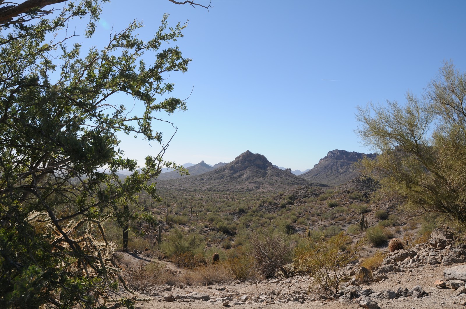 |
| Rock Peak and the Malpais Hills |
 |
| the "hang five" crested saguaro |
Part of the fun of visiting this desert park on the southeastern
fringe of Maricopa County is the drive down Ellsworth Road through Queen
Creek. It’s a 13-mile stretch of
cow pastures, cotton farms and horse corrals tossed together with acres of
stucco and strip malls. At the
base of this suburban-rural interface is San Tan Mountain Regional Park—10,200
acres of pristine Sonoran Desert with 20 miles of shared-used trails ranging in
difficulty from easy to strenuous. All of the park's nine trails are
well-signed and laid out so users can easily cobble custom treks, but when the
park ranger told me there was a rare crested saguaro and a petroglyph site on
the San Tan Trail (SA) , choosing a route was a no-brainer for me. Using the park map available for free
at the visitor center, I planned my hike around those two features. Except for a few places where the trail
follows sandy washes---which is similar to strolling on a beach---the route is
a walk in the park. One short, minor
climb leads to the crest of a ridge with astonishing views the park's signature
geological features---Rock Peak and the Malpais Hills. From this breezy vantage point, you can
do a visual walk through of the return leg of the hike. The petroglyph site is located a
quarter-mile downhill from the crest.
Look for a jumble of granite on the left. The rock art here appears to be quite ancient and only one
incised design stands out. To see the crested saguaro, continue past the Rock
Peak Wash junction, turn right to stay on SA and hike a few yards to where the
trail makes a sharp left swerve and heads up an embankment. From here, you can catch a first
glimpse the plant’s famous “hang five” (or "I Love You" in American Sign Language) gesture about 0.1-mile down the
path. To complete the loop,
continue hiking north and take any of these connector trails: Hedgehog,
Moonlight or Goldmine-Littleleaf.
 |
| Sonoran Desert "beach" |
LENGTH:
7.4-mile loop (6.4 on San Tan, 0.4 on Goldmine, 0.6 mile on Littleleaf)
RATING:
moderate-difficult
ELEVATION:
1,160’ – 1,800’
FEE: $6 daily fee per vehicle
FACILITIES: restrooms, water, visitor center, wildlife
exhibit, tortoise habitat, ranger-led activities
HOURS: open 365 days a year, Sunday-Thursday: 6 a.m. to 8
p.m., Friday-Saturday: 6 a.m. to 10 p.m.
PETS: leashed pets are allowed
GETTING THERE:
From Phoenix, travel east on US60 to Ellsworth Road exit
191. Follow Ellsworth 13.6 miles
south (Ellsworth turns into Hunt Highway after about 12 miles) to Thompson Road
(traffic signal), turn south (right) and go 2.1 miles to Phillips Road, turn
right again and continue 1 mile to the park entrance.
INFO: Maricopa County Parks & Recreation, 480-655-5554
MORE PHOTOS:
0 comments:
Post a Comment