JONES CROSSING
Near Clint’s Well
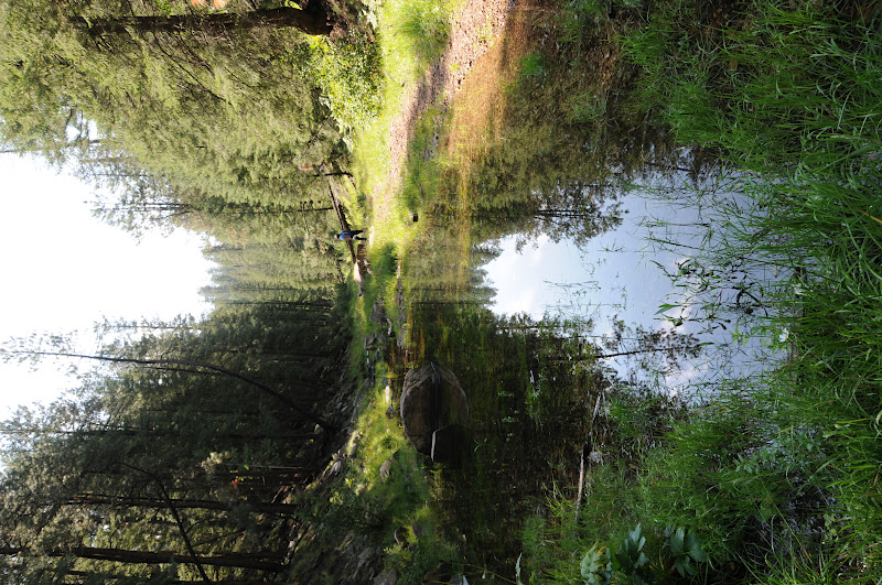 |
| East Clear Creek, Aug. 18, 2012 |
Now here’s a little slice of paradise wrapped in fragrant
pines and wildflower glory. The water of East Clear Creek nourishes a sweet
ribbon of green across the Mogollon Rim and a hike into the beautiful Jones
Crossing area of this perrenial stream rewards with exposure to an impossibly
lush canyon flanked by contorted limestone cliffs. The trek begins at Jones
Crossing bridge where hikers can follow the stream either north or south. We found the southbound strip more
scenic and better shaded. Right
out of the chute, the route---which roughly follows a closed 4x4 road----drops
hikers into a field of thigh-high grasses splattered with OxEye Daisies and
wild geraniums. From here, just
follow the water to enter a steep-walled canyon with intermittent pools and
trickling rivlets smothered in ferns and bobbing yellow Columbine. Water levels fluctuate so be prepared for wet feet as there
are a few spots where crossing does require some ankle-deep wading.

LENGTH:
Southbound (as described here): whatever---but it’s 5.2 miles
one-way to the Poverty Draw side canyon.
Northbound: whatever, but it’s 1.75 miles to an unsigned
forest road
RATING: easy,
with several creek crossings
ELEVATION:
6,850’ – 7,050’
GETTING THERE:

From the intersection of SR260/87 in Payson, go north on SR87 (Beeline
Hwy) past Pine-Strawberry to milepost 289 and the sign for Jones Crossing and
turn right onto FR 141. Continue 4 miles east on FR141 to the (signed) Jones
Crossing bridge and park along the road. FR 141 is maintained dirt with just a few minor bumpy parts--okay for slowly driven sedans.
Hike begins across of the bridge at the yellow “area closed”
and “732” signs. The area is
closed to all motorized vehicles, but hiking is okay.
MORE PHOTOS:
0 comments:
Post a Comment