
 WATERSHED TRAIL Prescott National Forest
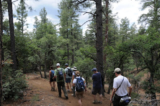
 Melding the sweet-scented breezes of pine forests with sunny hillsides blanketed in agaves, manzanitas and cactuses, a hike along Prescott’s Watershed Trail #299 is a trip through an ecological transition zone. The trail itself is a mash-up of wide old roads, groomed paths and eroded walkways---enhancing the hybrid flavor of the hike. At roughly the half-mile point, look for Deer Lick Spring, a concrete trough situated in a gully off to the right. Here, seeping water fosters an incredibly lush green zone shaded by tall Ponderosa pines flanked by beavertail cactuses bursting from rock outcroppings. Over its wavy route, the trail dips into ravines dotted with log homes and crosses high ridges for excellent views of Prescott area landmarks including Goldwater Lake and the distinctive stony peaks of Granite Mountain and Thumb Butte.
LENGTH: 8.6 miles roundtrip
RATING: easy-moderate
DOG RATING: 2 paws
ELEVATION: 6,200-6,900 feet
BEST SEASONS: March - November
DISTANCE FROM PHOENIX: 117 miles one-way
GETTING THERE: From downtown Prescott, go east on Gurley Street 0.3 miles to Mt. Vernon Avenue. Turn south (left) on Mt. Vernon for 4.1 miles as it turns into Senator Highway. The Watershed #299 trailhead is on the east (left) side.
INFORMATION: Bradshaw Ranger District 928-771-4700, www.fs.fed.us/r3/prescott/recreation/trails/pdf/rec_trai_b_watr299.pdf


 WATERSHED TRAIL Prescott National Forest Melding the sweet-scented breezes of pine forests with sunny hillsides blanketed in agaves, manzanitas and cactuses, a hike along Prescott’s Watershed Trail #299 is a trip through an ecological transition zone. The trail itself is a mash-up of wide old roads, groomed paths and eroded walkways---enhancing the hybrid flavor of the hike. At roughly the half-mile point, look for Deer Lick Spring, a concrete trough situated in a gully off to the right. Here, seeping water fosters an incredibly lush green zone shaded by tall Ponderosa pines flanked by beavertail cactuses bursting from rock outcroppings. Over its wavy route, the trail dips into ravines dotted with log homes and crosses high ridges for excellent views of Prescott area landmarks including Goldwater Lake and the distinctive stony peaks of Granite Mountain and Thumb Butte. LENGTH: 8.6 miles roundtrip RATING: easy-moderate DOG RATING: 2 paws ELEVATION: 6,200-6,900 feet BEST SEASONS: March - November DISTANCE FROM PHOENIX: 117 miles one-way GETTING THERE: From downtown Prescott, go east on Gurley Street 0.3 miles to Mt. Vernon Avenue. Turn south (left) on Mt. Vernon for 4.1 miles as it turns into Senator Highway. The Watershed #299 trailhead is on the east (left) side. INFORMATION: Bradshaw Ranger District 928-771-4700, www.fs.fed.us/r3/prescott/recreation/trails/pdf/rec_trai_b_watr299.pdf
0 comments:
Post a Comment