Saturday, April 23, 2011

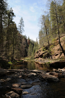
WEST FORK OF OAK CREEK


WEST FORK OF OAK CREEK


Sedona


Nine bucks. That’s what you'll shell out to visit this iconic Arizona hiking trail. Worth it? Absolutely! Because of its outstanding scenic qualities, this trail draws hoards of visitors from all over the globe. Today, I heard at least 5 different languages being spoken on the trail. The first .33-mile segment is barrier free, winding through an apple orchard flanked by soaring red rock ramparts on the west and the creek on the east. The pavement ends at a collection of early 20th century ruins. Here, the route turns to sandy dirt, following the stream up the canyon. Entirely canyon-bound, the path stays close to the water. Expect to make at least 12 creek crossings (one way) over the 3-mile course. Stepping stones and fallen logs serve as natural bridges, but during high-water periods, wading is required. Past the 2-mile point, the trail narrows and crowds tend to thin out. As the canyon closes in, vegetation goes viral—wildflowers, brambles, alders, maples, willows, dogwoods and countless vines cloak the route in an eerie veil of green. The official forest service trail ends at the 3-mile point. (This works out just fine because most of the really cool sights happen in this short segment). From here, there’s roughly


another half-mile of decent trail before steep cliffs, abysmal pools and a quagmire of underbrush swallow the route. Hiking beyond this point requires swimming, wading and advanced canyoneering skills---proceed with caution.


LENGTH: 3.3 miles one-way (on trail) OR up to 14 miles (with wading, swimming & climbing)


ELEVATION: 5,280’ – 5,520’


RATING: easy (on trail), moderate –difficult beyond trail’s end


GETTING THERE:


From Phoenix, go north on I-17 to exit 298 (Oak Creek-Sedona) for SR 179 North. Go left (west) on SR179 and continue to the “Y” intersection (roundabout) with SR89A in Sedona. Veer right (northeast) on 89A and go 10.3 miles to the Call of the Canyon Day Use Area (between mileposts 384 & 385) on the left (west) side of the road—sign will read ‘West Fork”. Roads are 100% paved.


DISTANCE FROM PHOENIX: 135 miles one-way


FEE: $9 daily fee per vehicle (up to 5 passengers). $2 per person daily fee for walk-in or bike-in.


HOURS: 9 a.m. to 8 p.m. (summer), 9 a.m. to dusk (winter). The gate usually opens around 8 a.m.. Use the self-pay kiosk if an attendant is not available.


DOGS: leashed dogs okay—bring poo bags and pack out all pet waste.


FACILITIES: restrooms


MORE PHOTOS:


INFO: Coconino National Forest, Red Rock Ranger District


Tuesday, April 19, 2011

JUDITH TUNELL ACCESSIBLE TRAIL


2012 UPDATE:

this trail has been beautifully resurfaced--check it out!


Judith Tunell Accessible Trail, South Mountain Park Preserve Recently, I received and e-mail from a family visiting the Valley who wanted to know if there are any Phoenix area trails where they could bring a toddler in a stroller and a grandparent who uses a walker. No problem. Many City of Phoenix parks have barrier-free trails and one of the most interesting is the Judith Tunell loop in South Mountain Park. Designed to exercise the mind as well as the body, the trail features interpretive signs describing everything from the survival mechanisms of ironwood trees to the numerous depression-era Civilian Conservation Corps (CCC) projects located throughout the park. There’s even a rock face covered in ancient petroglyphs adjacent to the path. Additionally, water fountains, benches and covered ramadas placed along the wide, easy route make getting outdoors accessible to all. LENGTH: 1-mile (two half-mile loops) RATING: easy, barrier-free, maximum grade is 8.5% on stabilized granite. ELEVATION: 1,400 feet (flat) GETTING THERE: From downtown Phoenix, go south on Central Ave. to the entrance of South Mountain Park (south of Dobbins). Pass the main entry gate, take the first left and go roughly 0.25 mile to the Environmental Education Center on the right. The trail begins behind the center. Even though the center is temporarily closed due to budget cutbacks, the trail remains open. Nearest restrooms are located east of the Center at the end of the big parking lot (near the Holbert trailhead). HOURS: All gated roadways, trailhead parking areas, restrooms and ramadas are open from 5 a.m. to 7 p.m.. Trails remain open until 11 p.m. INFO: City of Phoenix Parks & Recreation http://phoenix.gov/parks/trails/locations/south/hiking/index.html, 602 262-7393

Saturday, April 16, 2011

WOLF CREEK FALLS


Visited Wolf Creek Falls again today with members and guests of Arizona Outdoor & Travel Club. Nice group, pleasant hike. The falls are still running strong!
See my prior Wolf Creek Falls blog entry for hike details.

Friday, April 8, 2011

PIMA CANYON WASH


PIMA CANYON WASH
South Mountain Park, Phoenix

Because of its close proximity to suburbia, the Pima Canyon recreation area draws the crowds--especially on weekends. From what I’ve seen, many people use the area as an outdoor treadmill-- speed hiking or power walking uphill on the wide dirt road heading west from the trailhead. Although all the traffic does tend to keep the resident pit vipers at bay, the trail gets a bit loud and congested. However, for those who prefer solitude and/or more of an exploratory hike, the Pima Wash Trail--located below the road---offers a slower, scenic meander through classic Sonoran desert terrain. With lots of sand and loose rock underfoot, the trail is hemmed in by weather-worn vertical cliffs decorated by centuries-old petroglyphs and inhabited by myriad critters including Harris Antelope Squirrels, rock squirrels and Turkey vultures. Although the official route ends at the junction with National Trail, it is possible to explore farther up the canyon if you don’t mind a little boulder hopping and hand-over-foot scrambling. If you choose the exploratory option, please respect the fragile terrain. Avoid stepping on native plants and pack out what you pack in.
LENGTH: 2.2 miles one-way to National Trail junction (official trail) OR
3.3 miles one-way to canyon end
RATING: easy-moderate
ELEVATION: 1,390 – 1, 690 (1,990 if you continue up the canyon beyond the National Trail Junction)

GETTING THERE:
From Phoenix, go east on I-10 to the Elliot Road exit. Go a couple blocks west (go right) on Elliot to 48th Street (major stoplight intersection), turn right (north) and go exactly 1 mile on Elliot to where the road splits just before Guadalupe Road. Take the left fork toward the golf course (which is the continuation of 48th St. Hint: if you reach Guadalupe Road, you’ve gone about a half-block too far---just make a U-turn and backtrack) and go a few yards to a guard gate on the left---there’s a City of Phoenix sign, but it’s not prominent. Turn left here onto Pima Canyon Road (no signs) and follow it all the way to the end—or park in any of the designated spots along the road.
FINDING THE TRAILHEAD: Access to Pima Wash begins near the first ramada on the right (north) side of Pima Canyon Road at the “West Loop” sign where there are trash bins and a poop bag station—see photo for reference. Follow West Loop downhill roughly 0.1 mile to the signed Pima Wash junction.
FACILITIES: restrooms, water, covered picnic ramadas.
DOGS: canines must be on leash at all times and owners must bring poop bags and clean up after their pets.
FEES: none as of April 2011

Wednesday, April 6, 2011

WATER WHEEL FIRE UPDATE

WATER WHEEL-ELLISON CREEK OPEN Tonto National Forest Good news, hikers, as of April 1, 2011, the Water Wheel-Ellison Creek area off Houston Mesa Road north of Payson has been reopened for day use ONLY. Due to the 2009 human-caused Water Wheel Fire, this primo hiking destination has been off limits-- but no more. Here’s the rub---there’s now an $8 per person day use fee. Self-service kiosks are posted at key access points. Hikers must deposit cash (bring exact change) into provided envelopes and carry the detachable permit stub while inside the fee area. Forest Rangers are aggressively enforcing this new fee---and fines are much more than $8!! RULES: DAY USE ONLY--no camping, no fires.

See my previous Water Wheel and Ellison Creek blog entries for hike directions.

MAP:

http://www.fs.usda.gov/Internet/FSE_DOCUMENTS/stelprdb5208054.pdf

HOUSTON LOOP


One of the Seismic Bunkers
HOUSTON LOOP Payson During the Cold War Era, Payson was a prime location for spying on the "commies"-- and the remains of a couple of seismic bunkers used in the cause still stand in the forests along the Houston Loop Trail. Perhaps they were/are associated with the Tonto National Forest Seismological Observatory, I’m not sure. What I was able to glean from the paltry historical public records is that the bunkers were used to house equipment that measured the rumblings of nuclear weapon testing across the globe. Kewl. It’s stuff like this that makes hiking the little trails like Houston Loop so much fun. Sure, it’s short and kinda easy, but few hikes offer a nostalgic glimpse of a time when the world was held hostage by  Atom-Bomb hysteria.  Although accessible, I did not explore within the one bunker I located because it smelled like, oh I don’t know---urine, maybe? This has not deterred beer-toting graffiti hooligans from lying siege to this relic of our great nation’s 1950-60s “duck and cover” days--as evidenced by a bevy of empty Bud Light cans littering the area. They've turned this idyllic woodland into a squalid kingdom of debauchery. Heed their crudely scrawled advise and "leave this place". But, I do digress--back to hiking. A pleasant stroll, this little loop connects with the longer Houston Mesa Trail and offers nice views of the chaparral-pine forests surrounding Payson. The route crosses two seasonal creeks—Mayfield and Houston---where water flows during spring snowmelt season and after rainstorms. The trail is wide, well signed and has only a few steep segments, making for a quick, carefree hike. I did this in combination with the Goat Camp Ruins Trail (see separate blog entry), which connects to the Houston Trail. From there, hike about 2 miles east to the Houston Loop. LENGTH: 4.5-mile loop from the Chaparral Ranch trailhead OR 9.6 miles roundtrip from Houston Mesa trailhead ELEVATION: 4,800’ – 4,950’ (Chaparral) OR 4,800’ – 5,200’ (Houston Mesa)

BEST SEASON: September - May RATING: moderate GETTING THERE: CHAPARRAL RANCH TRAILHEAD: From the intersection of SR 87/260 in Payson, go right (east) onto 260 and continue 2.4 miles to Chaparral Pines Drive. Turn left (north) and go 1.2 miles to the Chaparral Ranch Trail access turnout. Parking is very limited--room for 3-4 cars max. Do not block private driveways in the area. Large groups should access this trail via the Houston Mesa Trailhead. HOUSTON MESA TRAILHEAD: From the intersection of SR 87/260 in Payson, go 1.7 miles north on 87 to Houston Mesa Road. Turn right (east) and continue 0.8 mile to the trailhead on the right (past the “horse camp”). From here, follow Houston Trail 3 miles to the loop. INFO: http://www.paysonrimcountry.com/MountainRecreation/HikingTrails/PaysonAreaTrailsSystem.aspx

GOAT CAMP RUINS


GOAT CAMP RUINS
Payson

Unless you know what to look for, you’ll likely walk right past the Native American ruins for which this trail is named. That’s because the site is in an un-restored state. The remains of a pit house and various other structures are highly eroded. I could see the footprint of at least 4 ruins—but then again, I’m a geek.
This short connector route makes for an interesting alternative access point when hiking the Houston Mesa Trail.
Future plans for this six-acre site include development of a “passive archeological park” similar to the Shoofly Ruins off Houston Mesa Road. There’s no signage to lead you to the ruins, however, obvious footpaths leaving the main trail serve as clues. From the Goat Camp-Houston Trail junction gate you can go left to get to the horse camp or go right and hike 2.5 miles to the Houston Loop hike described in a separate blog entry.
LENGTH: 0.3 mile one-way to the Houston Trail junction.
ELEVATION: 5,080’ – 5,100’
RATING: easy
THE RULES: open to foot traffic ONLY. Leave what you find—it’s illegal to remove items or alter heritage sites. Please be respectful.

GETTING THERE:
From the intersection of SR87/260 in Payson, go 1.8 miles north on SR87 to Tyler Parkway (across from Home Depot). Turn right and go 0.8 mile to the signed trailhead on the north (left) side of the road. For reference, look for a “staircase” near two utility boxes.
INFO: Payson Area Trails System
http://www.paysonrimcountry.com/MountainRecreation/HikingTrails/PaysonAreaTrailsSystem/GoatCampTrail.aspx