Saturday, February 19, 2011

MORMON LOOP


MORMON LOOP
South Mountain Park, Phoenix


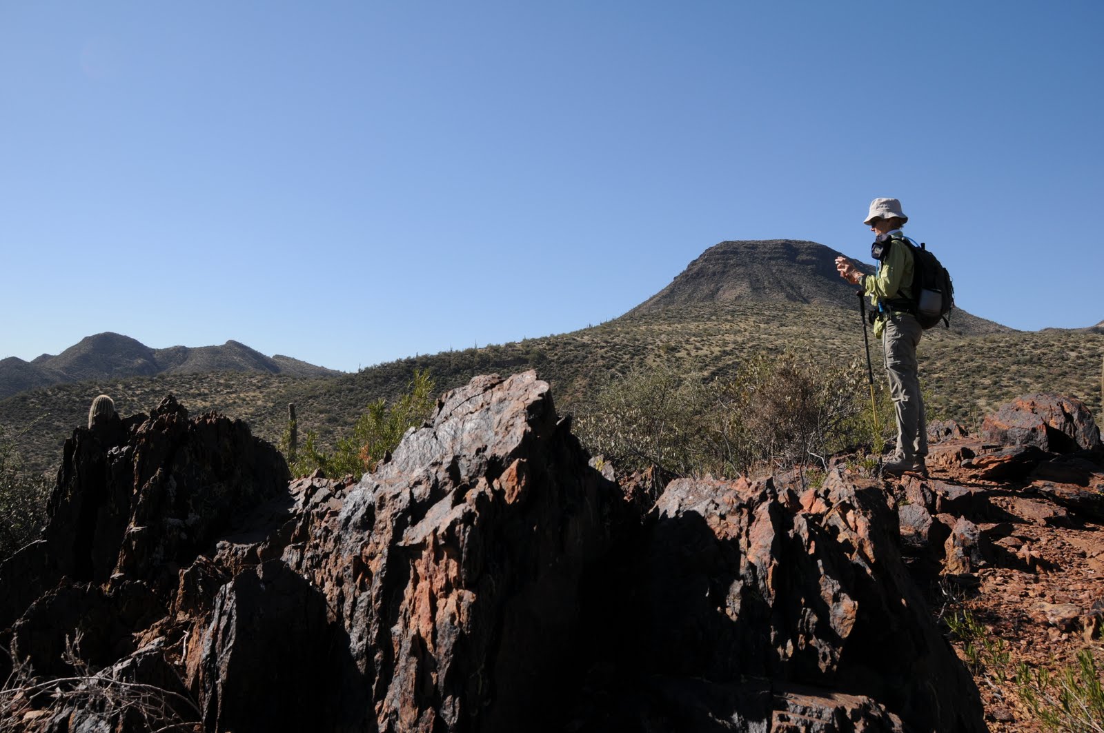
Rain schmain---although the National Weather Service predicted a 100 percent chance of rain for the Phoenix area today, we simply HAD to get out and hike. Our original plan was to head out to the White Tank Mountains. However, by 8 a.m., the range was already immersed in deep cloud cover and the majority of my hiking pals had opted out---except for two diehards. From our meeting place vantage point, we could see clear skies over South Mountain Park and it looked as if the track of the approaching storm would give us a few hours to hike a trail there before the rain set in. So, off we went. We selected the Mormon Loop trail because two of us hadn’t been there in several years. With its easy access, clearly signed junctions and amazing terrain, we weren’t surprised at all to find the trail teeming with hikers and bikers-- despite the ominous weather forecast. The first mile climbs up into the hills featuring some pretty great views of Metro Phoenix. After that, the route descends into the Beverly Canyon-Hidden Valley area for a more remote feel. Adding a bit of history to the hike, several Hohokam petroglyph sites line the route--the best one is located just before the National Trail junction. We also made a quick side trip to Hidden Valley’s natural tunnel (turn left at the Hidden Valley trail sign and hike a few yards to the tunnel) before completing our loop just before the skies dumped some much-needed rain on our desert town.


HIKE DIRECTIONS: Begin on the Mormon trail hiking uphill 1 mile to the Mormon Loop junction. Turn left here and continue 1.1 miles to the National Trail junction (there’s a HUGE rock pile here in addition to park signage). Veer right and hike 1.4 miles on the National Trail to the Hidden Valley Junction. From here, keep right to stay on the National Trail, hike another 0.4 mile back to the Mormon Loop Junction and head downhill back to the trailhead.
LENGTH: 5 mile loop
RATING: moderate
ELEVATION: 1,400’ – 2,000’
GETTING THERE: From central Phoenix, go south on 7th Ave to Baseline Road. Head east (left) and continue to 24th Street. Turn south (right) onto 24th Street and follow it all the way to the end (veer left at Euclid) to the signed trailhead.
FACILITIES: parking, shaded kiosk, no restrooms or water. No fees.
DOGS: leashed dogs are welcome. Please bring poop bags and clean up after your pets.
BEST SEASONS: October-April
INFO: phoenix.gov/parks/hikesoth.html
MORE PHOTOS: http://www.facebook.com/album.php?aid=49590&id=1795269672&l=5a1a104412

Thursday, February 17, 2011

WILLOW CANYON-MESQUITE LOOP


WILLOW CANYON-MESQUITE LOOP
White Tank Mountain Regional Park, Waddell


Ingeniously engineered to sample all that’s great about the White Tanks, this loop route is a perfect way to get to know the terrain of this range buttressing the western edge of Metro Phoenix. Even with punishing budget cut backs and staff reductions, Maricopa County somehow manages to keep our regional parks clean, maintained and safe. Your six-buck park entry fee is put to good use.
Known for its beautiful white granite “tanks” (depressions in the rock scoured out by running water) and graceful, meandering trails, the park harbors a surprising amount of water. The coolest water hole I’ve seen there can be found off of the Willow Canyon (WL) trail. To get there, start at the Mesquite Trail (MQ) sign at Ramada Way. I like to start here instead of at the trailhead staging area because I find the extra 0.9-mile trek flat and dull---better to get to the good stuff quicker. Hike 1.7 miles on MQ and pick up the Willow Canyon (WL) trail heading northwest (go right at the sign). Willow Canyon trail is only 1.6 miles in length and the spring area spur is located off to the left near an old gate. This makes for a good place to take a break before continuing on WL to the Ford Canyon junction. Here, go south (left) and hike 0.7 mile to the MQ trail, and head east (left) to complete the loop.
PHOTOS: For old times sake, I dug these photos out of my 2004 files. They were taken with a crappy point-and-shoot camera, so they’re not the best quality. Bear with me---I’m hauling the big lens out there this weekend.

LENGTH: 10 miles roundtrip from Trailhead (horse) Staging Area OR 8.1 miles roundtrip from the Ramada Way trailhead.
RATING: moderate
ELEVATION: 1,600 – 2,995
DISTANCE FROM PHOENIX: 45 miles one way
GETTING THERE:
From Phoenix, go 18 miles west on I-10 to Loop 303. Go north on 303 to Olive Ave., turn west and follow Olive all the way to the end at the park entrance.
TRAILHEAD (HORSE) STAGING AREA: Once inside the park, go north on the main drag—White Tank Mountain Road— roughly 1.2 miles to the signed staging area on the right.
RAMADA WAY TRAILHEAD: Once inside the park, go north on the main drag—White Tank Mountain Road— roughly 1.2 miles and turn left onto Waterfall Canyon Road and go 0.8 mile to Ramada Way. Turn left onto Ramada Way and follow it 0.2 mile to the trailhead.
FACILITIES: maps available at the park entrance, restrooms, picnic ramadas, horse staging, nature center.
HOURS: Park hours vary, check Web site for current info. All trails close daily at sunset.
DOGS: leashed dogs are allowed. Owners must bring poo bags and clean up after their dogs.
INFO: Maricopa County Parks & Recreation, 623-935-2505
http://www.maricopa.gov/parks/white_tank/

Friday, February 11, 2011

PASS MOUNTAIN


PASS MOUNTAIN TRAIL
Usery Mountain Recreation Area, Mesa

A perennial favorite, we made a return trip to this trail last week---always a good choice for a beautiful local hike.
There are actually many access points (both within the Usery Recreation area and via Tonto National Forest) to the Pass Mountain Trail as you will see on the map that is available at the park entrance. The counter-clockwise hike we did is easier and shorter than starting the hike elsewhere. Well-maintained and easy to follow, the trail makes a wide loop around Pass Mountain--the signature landmark of Usery Mtn Park--through desert terrain before climbing to a scenic pass overlooking the Salt River Valley, Goldfield and Superstition mountains.
Although there weren’t yet many wildflowers in bloom, impending warmer temperatures over the next few weeks will coax out the color and vivid green leaves of the ocotillos that grow profusely along the cliffs. This is an EXCELLENT place to see Mexican Gold poppies and lupines.
The park is open from 6 a.m. to 8 p.m. and offers nearly 30 miles of trails, many nice picnic areas and plentiful restrooms.
LENGTH: 7.4-mile loop
RATING: moderate
ELEVATION: 2,030 – 2,588 feet
BEST SEASONS: October - April
GETTING THERE:
From Phoenix, take US 60 east to exit 191 which is Ellsworth and go north. Continue on Ellsworth (which will turn into Usery Pass Road) for 6.7 miles and then turn right onto Usery Park Road. Follow the signs to the Horse Staging Area and park there. The trail begins at the east side of the lot. There are porta potties but no water here. Other parking areas have flush toilets, water, and canned soda machines.
FEES: $6 daily fee per vehicle payable at the park entrance
INFO: Maricopa County Parks & Recreation, 480-984-0032,
http://www.maricopa.gov/parks/usery/pdf/2010maps/usery-8x11.pdf

Tuesday, February 8, 2011

PHOENIX SUMMIT CHALLENGE 2011

2011 PHOENIX SUMMIT CHALLENGE The City of Phoenix Parks & Recreation department has released the dates for the 2011 Phoenix Summit Challenge. The 7th annual event will take place on Nov 4-6, 2011. More details will be announced this summer. Check the link below for updates. http://phoenix.gov/recreation/rec/parks/preserves/specials/summit/index.html For more information call 602-495-5458 or e-mail: natural.resources.pks@phoenix.gov

Saturday, February 5, 2011

JAVELINA-RIDGELINE-BEVERLY CANYON LOOP

JAVELINA-RIDGELINE-BEVERLY CANYON LOOP South Mountain Park, Phoenix Seriously, this desert route had been rotting on my “C” to-do list for years---mainly because of the ugly trailhead. So I put off hiking it until this past week. Now, I wish I hadn’t been so quick to judge. The trailhead is indeed, an eyesore--plopped in the middle of a noisy industrial park. From this vantage point, the trail appears to have few redeeming qualities. None-the-less, I prepped my camera and hit the dirt. The first half-mile had me thinking this trek was closer to a “D”-lister. After that though, things began to improve. Once out of earshot of the annoying “air products” (what ever the heck that is) factory, the hike takes on a calmer tone. Nicely maintained, the Javelina Trail makes a gentle climb through classic South Mountain desert terrain. Ironwood and Palo verde trees clutter bajadas and ravines flanking the path. Abundant brittlebush shrubs and strawberry hedgehog cactuses will undoubtedly put on a colorful flower show in spring. I was surprised to see a coyote, red tail hawk, ground squirrel, woodpeckers galore and a gaggle of quail. The Ridgeline Trail junction marks the beginning of the best part of the hike. This short rollercoaster-type trail rides a knife-edge ridge bisecting Javelina and Beverly Canyons for some breezy exposure and views that stretch from Camelback Mountain to the Four Peaks. The final segment on the lower part of Beverly Canyon Trail follows a path beneath power lines and isn’t anything to write home about--unless you like viewing vandalized petroglyphs (grrrrr). Suffice to say, this loop has been moved to my “been there, done that” list with a respectable B- rating. I will go back for wildflower season. HIKE DIRECTIONS: Begin on the Javelina Trail at the west side of the parking area. Follow Javelina 1.7 miles to the Ridgeline Trail junction. Veer left (east) and continue on Ridgeline 0.9 mile to the Beverly Canyon Trail junction. Go left (northeast) and hike 1.3 miles back to the trailhead. LENGTH: 3.9-mile loop RATING: easy (with a few steep sections) ELEVATION: 1,230 – 1,750 feet BEST SEASONS: October-April THE RULES: trailhead closes at 7 p.m.. Dogs must be on leash and there are free poop bags at the trailhead. GETTING THERE: From central Phoenix, go east on I10 to the 40th Street exit. Go south on 40th Street to Baseline Road and go east (left) to 46th Street. Turn right at the 46th Street light and continue roughly 0.5 mile through an industrial park to the end of the road and the signed Beverly Canyon trailhead. There’s plenty of parking, but no facilities.

TEMPORARY TRAILHEAD RE-ROUTE FOR 2011- SPRING 2013: 

http://phoenix.gov/webcms/groups/internet/@inter/@rec/@parks/@parks/@nrd/documents/web_content/055200.pdf

  INFO: City of Phoenix Parks & Recreation.

http://phoenix.gov/PARKS/hikesoth.html

Tuesday, February 1, 2011

FOREST ROAD 1053 LOLLIPOP LOOP


FOREST ROAD 1053 LOLLIPOP LOOP
Spur Cross Ranch Conservation Area/Tonto National Forest


Melding spectacular Sonoran Desert vistas with willow-choked riparian corridors, this hike begins on a popular horse trail and tops out on a seldom-visited old road in Tonto National Forest. It’s normal to have to make several creek crossings in this area, but this year, we noticed a lot of erosion, and in fact, a section of FR48 was completely flooded—requiring hikers to make a tricky double creek hop to stay on track---I counted a total of 12 crossings (out and back) this time out. The beauty of FR 1053 is that it gets high above Cave Creek for sweet views of the waterway and a mine off to the west. Also, the local stables that conduct horseback riding tours heavily use this road. So, remember that hikers must always yield to equines—move aside and let them pass---and also be wary of “horse apples” underfoot.

HIKE DIRECTIONS: From the parking area, hike 1.2 miles north on Spur Cross Trail (go straight ahead at the visitor center) to the Tonto NF boundary gate. From this point, Spur Cross Trail becomes Forest Road 48. Pass the gate and continue 1 mile to the Skull Mesa trailhead---there’s a big sign across the creek, but its partially hidden by brush, so , keep an eye out for it. From the sign, go left (northwest) along a skinny, unmarked path where there’s some metal grating. After a few yards, you’ll see a lathe-type “48” sign on the right. Continue uphill for 0.9 mile to where the trail dips into a gully near the creek with high red cliffs straight ahead. The trail seems to disappear here, but it actually crosses the creek. Depending on the water level, you may need to hunt for a good crossing point. Once on the other side, though, the path is very clear heading up the embankment and leaning north. After a few yards, a spur path veers to the left---it goes to an abandoned mine on private property---not this hike. Instead, stay north (veer right) and make another creek crossing almost immediately. A short walk brings you to a “Y” intersection---take the right leg (marked with a “1533” sign). Follow this road uphill (it will become FR 1053, but there are no signs to indicate this) and continue 0.8 mile to a gate at the Cave Creek Trail #4 junction. From here, go straight and hike 0.5 mile back to the Skull Mesa trailhead and then hike 2.2 miles back to your car.
LENGTH: 9.4 miles roundtrip
RATING: moderate
ELEVATION: 2,300 – 2,800 feet
BEST SEASONS: October -April


GETTING THERE: From Loop 101 in Scottsdale, exit at Cave Creek Road and drive north for approximately 15 miles to Spur Cross Ranch Road--watch for the “Spur Cross Ranch Conservation Area “ sign marking the turnoff. Go left on Spur Cross and then make another sharp left at the intersection with Grapevine Road. Continue north on Spur Cross 4.2 miles to the dirt parking lot on the left. The last mile or so of the road is good dirt and passable by sedan.
FEE: $3 daily fee per person. Bring exact change for the self-serve permit kiosk.
INFORMATION: visit, http://www.maricopa.gov/parks/spur%5Fcross/ or call 480-488-6623

MORE PHOTOS: http://www.facebook.com/photo.php?pid=755601&l=224472bf1b&id=1795269672