Sunday, December 30, 2012

Short fitness trail


HILLTOP TRAIL


McDowell Mountain Regional Park, Fountain Hills


Jump start your New Years resolutions


Before reading this blog post, please insert the following
earworm in your brain:  the theme
song from the Rocky films. Ready. 
Set. Go.  Instead of the
Philadelphia Museum of Art stairs, or ballpark bleachers---use this trail.  'Nuf said.


LENGTH:  0.5-mile
up-and-back


RATING:  easy


ELEVATION: 
1860' - 1961'


FEES:  $6 daily
fee per vehicle, $2 walk or bike-in, annual passes available.


FACILITIES: 
restrooms, water, visitor center, picnic tables, camping


GETTING THERE:


From Phoenix, go east on Loop 202 to Beeline Highway (SR87).
Head north on SR87 to Shea Blvd, turn left and drive less than a mile to
Saguaro Blvd, turn right and continue to Fountain Hills Blvd, turn right and
continue 4 miles to the park entrance. Pay your fee and drive thru the park to
the main trailhead staging area at the end of Shallmo Drive.  Maps are available at the park entrance
and visitor center.


INFO: Maricopa County Parks & Recreation, 480-471-0173


MORE PHOTOS:


Thursday, December 27, 2012

Ridgeline hike above the Verde River Valley


SCENIC TRAIL


McDowell Mountain Regional Park, Fountain Hills


Holiday surprise on the trail: Dec. 24, 2012


With 20 trails laced over 21,000 acres of Verde River Basin
desert, selecting a hike in this northeast Valley county park can be a dilemma.
Therefore, I submit a suggestion---begin with Scenic Trail to get a fast and
easy overview of the park layout. 
Scenic Trail leaves from the main trailhead staging lot making a
lasso-loop up and over the Lousley Hills. 
Although the Rio Fire ravaged some of the area in 1995, once up on the
ridgeline, the land returns to beautiful Sonoran desert glory.  Because much of the route follows the
backbone of the Hills, the trail lives up to its name by offering double-edge
views of the entire park, the town of Fountain Hills (look for the famous
fountain at the top of each hour), the Verde River Valley and the green pecan
and citrus farms of the Ft McDowell Indian Reservation.  A memorial bench on the crest provides
a nice meditation or water break spot. 
Here, look for an unusual crested saguaro on the downhill slope.  It's unique because the fan-like
deformation is on one of the cactus' arms instead of on the top.


Overlooking the Verde River Valley


LENGTH:  4.3-mile
loop


RATING: 
moderate


ELEVATION: 
1860' - 2011'


FEES:  $6 daily
fee per vehicle, $2 walk or bike-in, annual passes available.


FACILITIES: 
restrooms, water, visitor center, picnic tables, camping


GETTING THERE:


From Phoenix, go east on Loop 202 to Beeline Highway (SR87).
Head north on SR87 to Shea Blvd, turn left and drive less than a mile to
Saguaro Blvd, turn right and continue to Fountain Hills Blvd, turn right and
continue 4 miles to the park entrance. Pay your fee and drive thru the park to
the main trailhead staging area at the end of Shallmo Drive.  Maps are available at the park entrance
and visitor center.


A curious coyote checks us out


INFO: Maricopa County Parks & Recreation, 480-471-0173


MORE PHOTOS:


New Years Eve Day guided hike

SUNRISE PEAK

McDowell Sonoran Preserve


Sunrise Peak


End the year on a high note atop Sunrise Peak with volunteer stewards of the McDowell Sonoran Preserve.  This guided trek with some steep sections is open to experienced, hardy hikers.  Click the link below to learn more.


LENGTH: 6 miles

RATING: moderate-difficult

ELEVATION GAIN: 900 ft

DATE: Monday, Dec 31, 2012

TIME: meet 7:45 sharp

PLACE: Lost Dog Wash trailhead, Scottsdale

INFO:

http://mcdowellsonoran.org/event/displayEvent/46#sthash.kKE1RbJa.dpbs

Sunday, December 23, 2012

The super volcano in our backyard


DUTCHMAN'S-BLACK MESA-SECOND WATER LOOP


Superstition Wilderness


Recent rains wet the washes: Dec. 22, 2012


So, now that we've survived the Mayan calendar end of the
world scenario, let's take a step back in time to reflect on what a fire and brimstone extinction event might have looked like.  Fortunately, we can hike on the slag of
just such a cataclysm---just pick any trail in the western Superstition
Wilderness.


Weavers Needle


Stepping out on Dutchman's Trail


Between 25 and 15 million years ago, the craggy outback we
know as the "Supes” was a churning cauldron of molten rock and white-hot
volcanic cinders.  Here, the
earth-borne violence was on the scale of what geologists call "super
volcanoes"---incomprehensibly massive eruptive forces that spewed ash over
thousands of miles.  As the firestorms
wound down, the volcanoes collapsed to form a chain of deep depressions known
as calderas.  Today, what remains
of this maelstrom is a tumultuous landscape of bizarre hoodoos and eroded
pillars of fused ejecta called "welded tuff".  Although this type of geology does not
produce prime pickings for gold hunters, myths that the Lost Dutchman's Mine (and its rich cache) is hidden in this wilderness persist--adding colorful lore to the stark, rugged landscape.  First Water Trailhead is the major
gateway to the western edge of Superstitions providing access to major hiking
routes that crisscross the 160,200-acre badlands.  A relatively mild way to experience the guts of this terrain
in a day hike is to make a loop with Dutchman's, Black Mesa, and Second Water
trails.  The loop moves among some
of the Supe's most awe-inspiring landmarks---deeply incised canyons of igneous
rock, Yellow Peak (3061') and the area's signature feature, 4553' Weaver's
Needle.  Contrary to what many
people think, the needle is not a volcanic plug.  It's just eroding tuff like most everything else around it. So
hike soundly fellow trekkers, Weaver's Needle will not pelt our trails in a
fury of molten rock.  We'll have to
settle to marvel in its deterioration as it slowly crumbles to dust over the
next 100 million years.


HIKE DIRECTIONS:


From the trailhead, follow the access path 0.3 mile to the
Dutchman's Trail #104 junction. 
Veer right (south) and follow #104 3.9 miles to the Black Mesa Trail
#241 junction.  Turn left
(northwest) here and continue 3.0 miles on #241 to the Second Water Trail #236
junction, turn left (south) and follow #236 1.5 miles back to the Dutchman's
junction, turn right and hike 0.3 mike back to the trailhead.


Hoodoos 


LENGTH:  9-mile
loop


RATING: 
easy-moderate


ELEVATION: 
2,270' - 2,750'


FACILITIES: 
restrooms, map kiosk


FEE: NONE at First Water trailhead.


GETTING THERE:


From Phoenix, go east on US60 to the Idaho Road (SR88)
exit.  Turn left and follow Idaho
to SR88 and turn right.  Follow
SR88 to First Water Road (FR78), which is located about a half mile past the
entrance to Lost Dutchman State Park (between mileposts 201-202) and signed for
First Water Trailhead. Turn right on FR78 and go 2.6 miles to the trailhead.


INFO: Mesa Ranger District, Tonto National Forest,
480-610-3300


MORE PHOTOS:


Friday, December 21, 2012

Hike to help adoptable dogs

GET FIT WITH A PIT CHALLENGE


Register now to help a local animal rescue organization socialize their dogs during this January promotion.  You'll be walking/hiking adoptable dogs for a chance to earn t-shirts and other prizes---not to mention bringing attention to some really great canines looking for forever homes.


TO REGISTER & LEARN MORE:

call 623-396-8466 or visit:

https://www.facebook.com/GetFitWithAPitChallengephoenix

Wednesday, December 19, 2012

Hike a desert river gorge


BURRO
CREEK


Near
Wickenburg


Picking our way through the willows


Route passes under Burro Creek Bridge on US93


Betcha
haven’t hiked THIS one. Burro Creek is a 23-mile-long desert
waterway located in the rugged and remote Bureau of Land Management
wilderness north of Wickenburg. There’s no “official”
trail--just follow the creek. Conditions vary according to water
levels. In dry times, it’s possible to hike for miles without
getting wet feet. However during periods of heavy rain and snowmelt,
wading is required. The area is known for its active wildlife
including beavers, javalina, shore birds and the marauding herds of
wild burros for which the creek is named. Soaring copper-colored
cliffs, mesquite-cottonwood forests, expansive desert views and the
graceful arch of Burro Creek Bridge round out the sights. Private
properties owners in the area guard their turf jealously. As long as
you park in the Burro Creek Campground and stick to hiking in the
creek bed, you’re legal.


Winter hike on Burro Creek


LENGTH:
6-9 miles round trip (without bush whacking and wading)


RATING:
difficult


ELEVATION:
1,960
– 2,100 feet


DISTANCE
FROM PHOENIX:

114 miles 1-way. Roads are paved up to the last 1.5 miles, and
passable by sedan.


GETTING
THERE:

In Wickenburg at the intersection of US60 and US93, go north on US93
for 59 miles to the turnoff for Burro Creek campground—between
mileposts 140 and 141. Turn left (west) onto the campground access
road and continue 1.5 miles to the parking lot. Facilities include
restrooms and running water.


Wednesday, December 12, 2012

Dream of wildflowers. Howl at the moon.


MOONLIGHT-STARGAZER-SAN TAN-HEDGEHOG LOOP


San Tan Mountain Regional Park


I'm keeping this one on my list to re-visit during spring
wildflower season.  That's because by then, the ironwood trees lining the park's numerous washes will be laden
with pink, pea-like blooms and the now-dormant strawberry hedgehog cactuses
will be dressed up in fragrant, fusha-colored blossoms.  But, right now,  our cool winter weather makes hiking
this open-to-the-sky (shadeless) trail system a real treat.  With a soft treadway and enough
directional signage to keep even novice hikers on track, this loop is just
right for a quick outing with kids or even non-hiker (our winter visitor) types.


Also--as their names suggest--the Moonlight and Stargazer
trails offer front row quality night sky viewing.  In fact, there's a ranger-led full moon hike coming up on
December 28th starting at 7 p.m.
(moonrise that day is 6:06 p.m.). FULL MOON
HIKE INFO:
http://www.maricopa.gov/parks/santan/EventsDetailPublishers.aspx?EventID=18705


DIRECTIONS FOR LOOP DESCRIBED HERE:


In case you don't get a free map from the visitor center or trailhead kiosk: From the main trailhead, begin
on Moonlight Trail (ML), hike 1.2 miles to the San Tan Trail (SA).  Turn left (south and hike 1.5 miles to
the Hedgehog Trail (HG).  Turn left
(north) and continue 1 mile to SA, turn left and go 0.3 mile to Stargazer
Trail.  Turn left hike 0.8 mile to
ML, turn right and hike 0.7 mile back to teh trailhead.


LENGTH:  5.5
mile loop


RATING: 
moderate


ELEVATION: 
1400'-1600'


FEE: $6 daily fee per vehicle


PARK HOURS: Sunday- Thursday: 6 a.m. - 8 p.m. , Friday-Saturday:
6 a.m. - 10 p.m.


PETS: leashed pets allowed


FACILITIES: restrooms, water, visitor center, wildlife
exhibit, tortoise habitat, ranger-led activities


GETTING THERE:


From Phoenix, travel east on US 60 to Ellsworth Road exit
191.  Follow  Ellsworth 13.6 miles south (Ellsworth
turns into Hunt Highway at about the 12 mile point) to  Thompson Road (traffic light), turn
right (south)  and go 2.1 miles to
Phillips Road. Turn right and continue 1 mile to the park entrance.


INFO: Maricopa County Parks & Recreation: San Tan
Mountain Regional Park, 480-655-5554


MORE PHOTOS:


Saturday, December 8, 2012

Desert beaches and a “hang five” saguaro


SAN TAN TRAIL


San Tan Mountain Regional Park, Queen Creek


Rock Peak and the Malpais Hills


the "hang five" crested saguaro


Part of the fun of visiting this desert park on the southeastern
fringe of Maricopa County is the drive down Ellsworth Road through Queen
Creek.  It’s a 13-mile stretch of
cow pastures, cotton farms and horse corrals tossed together with acres of
stucco and strip malls.  At the
base of this suburban-rural interface is San Tan Mountain Regional Park—10,200
acres of pristine Sonoran Desert with 20 miles of shared-used trails ranging in
difficulty from easy to strenuous. All of the park's nine trails are
well-signed and laid out so users can easily cobble custom treks, but when the
park ranger told me there was a rare crested saguaro and a petroglyph site on
the San Tan Trail (SA) , choosing a route was a no-brainer for me.  Using the park map available for free
at the visitor center, I planned my hike around those two features.  Except for a few places where the trail
follows sandy washes---which is similar to strolling on a beach---the route is
a walk in the park.  One short, minor
climb leads to the crest of a ridge with astonishing views the park's signature
geological features---Rock Peak and the Malpais Hills.  From this breezy vantage point, you can
do a visual walk through of the return leg of the hike.  The petroglyph site is located a
quarter-mile downhill from the crest. 
Look for a jumble of granite on the left.  The rock art here appears to be quite ancient and only one
incised design stands out. To see the crested saguaro, continue past the Rock
Peak Wash junction, turn right to stay on SA and hike a few yards to where the
trail makes a sharp left swerve and heads up an embankment.  From here, you can catch a first
glimpse the plant’s famous “hang five” (or "I Love You" in American Sign Language)  gesture about 0.1-mile down the
path.   To complete the loop,
continue hiking north and take any of these connector trails: Hedgehog,
Moonlight or Goldmine-Littleleaf.


Sonoran Desert "beach"


LENGTH: 
7.4-mile loop (6.4 on San Tan, 0.4 on Goldmine, 0.6 mile on Littleleaf)


RATING: 
moderate-difficult


ELEVATION: 
1,160’ – 1,800’


FEE: $6 daily fee per vehicle


FACILITIES: restrooms, water, visitor center, wildlife
exhibit, tortoise habitat, ranger-led activities


HOURS: open 365 days a year, Sunday-Thursday: 6 a.m. to 8
p.m., Friday-Saturday: 6 a.m. to 10 p.m.


PETS: leashed pets are allowed


GETTING THERE:


From Phoenix, travel east on US60 to Ellsworth Road exit
191.  Follow Ellsworth 13.6 miles
south (Ellsworth turns into Hunt Highway after about 12 miles) to Thompson Road
(traffic signal), turn south (right) and go 2.1 miles to Phillips Road, turn
right again and continue 1 mile to the park entrance.


INFO: Maricopa County Parks & Recreation, 480-655-5554


MORE PHOTOS:


Wednesday, December 5, 2012

Re-thinking Richinbar Mine


NEW PERSPECTIVES ON THE HISTORY OF RICHINBAR MINE


For your consideration.....


One of the great things about the blogosphere is its
networking opportunities.  Because of this blog, I
frequently receive emails from like-minded hikers and outdoor enthusiasts
telling me of obscure routes, warnings of road closures and contributing interesting
info about various AZ trails. 
Recently, local mineral expert Gary Carter shared some enlightening
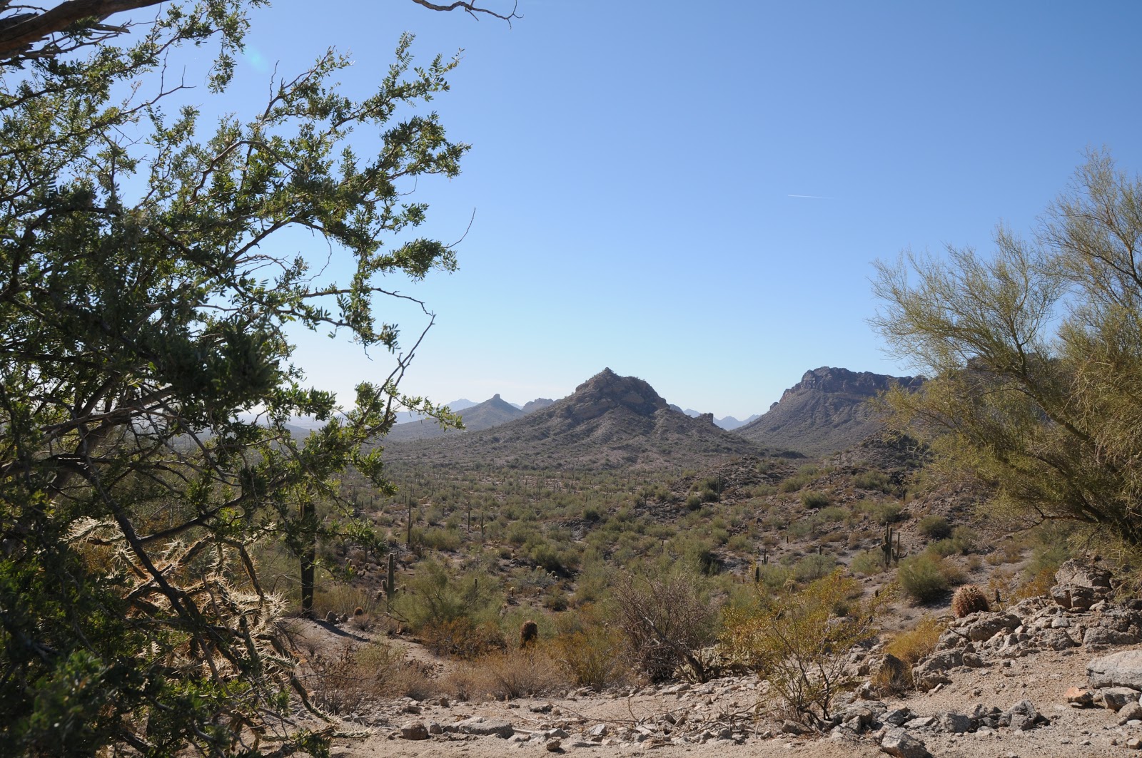
observations about Richinbar Mine (a very popular hike in the Agua Fria National Monument area) and gave me permission to share them with
you, to augment your understanding of the area's muddled history.  Here are Gary's findings:


The Richinbar Mine area—sure is an interesting old site
and easy to get to (which will eventually be its death).


Anyway, I have been out there many times and done some
detailed reading and observations about the area at the Arizona  Geological Society (downtown
Phoenix).They have a file of over 100 photos on  the Richinbar.


 My intent here is just to make sure you are aware of some
falsehoods about the mine.


•      The Az. Pioneer Cemetery
group are to be commended on what they are trying to do--however  not everyone agrees with their info or
interpretations—especially. those with background/training in geology/mining.
They also will not make corrections when they are notified of errors.


2     My background is in minerals and recently I also took an
exploration geologist of long standing and  high regard to the site ---to
confirm some of my thoughts and to see what else he could tell me. The  mine was not a rich
one—in fact they were in pretty low grade ore for much of the time, they operated  on a shoestring.


4      Copper was never a major product from that mine---it was
basically a tourmaline/ quartz vein with  minor gold they were following.


5      The two shafts further from
the mill workings were probably dug first since the concrete footings for the
first stamp mill are directly across from it on the Aqua Fria side of the
slope.


        The  dump of waste rock sits
right behind and below the Zyke shaft which fed the ball mill and circular
cyanide tanks that have left their tailings and depression . Not near enough
tonnage  to indicate they could or did process much ore.  A tailings pond (for waste
material) is still evident as a small plateau like area of pinkish cyanide
tailings below the now dry wash. There is no evidence –either
visual nor in the research of any graves or burials on the property.


I have been involved in so much
research on old mine sites where folks with no expertise or backup research
(other than what they read on the net) have added to the historical falsehoods,
myths and confusion. Can’t tell you how many phony stories –even TV docs and
videos have been circulated about the old Vulture Mine, outside of Wickenburg.
They were done by well meaning folks who did a modicum of reading, guessing and
hypothesizing—yet passed on inaccurate info about the subject. Once done it is
very difficult to “take it back” or correct it.


HIKE DETAILS:


LENGTH:  1.5
miles one way to the mine. 


(We wandered around the site for a total hike of just under
4 miles).


RATING: easy


ELEVATION: 3,370' – 3,497'


GETTING THERE:


From Phoenix, go north on I-17 (roughly 35 miles) to the
Sunset Point rest area.  From here,
continue 1.7 miles  to the turnoff
for FR9006 on the right.  A
windmill and stock tanks are your landmark. (if you reach Badger Springs Road,
you've gone 2.3 miles too far. Turn onto FR9006 and park in the dirt lot being
sure not to block the gate. The gate is usually locked, but it's easy (and
legal) to squeeze through.  
Roads are paved up to the dirt parking area.


INFO:


Agua Fria National Monument: general info and maps


Arizona Pioneer & Cemetery Research Project: historical
info and photos


Big Bug News: a story about a local who worked there


Monday, December 3, 2012

Colorful late Autumn desert hike


CAMP CREEK FALLS


Cave Creek


Early December on Camp Creek


Camp Creek Falls


The innocuous, wildfire-tinged roadside
pullout that marks the beginning of this hike gives little insight to
the wonders that lie in the canyons below. This unmarked route
ventures into the craggy desert canyons of Blue Wash and Camp Creek.
Although this is not an “official” trail, it’s easy to stay on
course by simply following the obvious footpaths and bends in the
canyon. The first of several tricky spots happens at roughly the
half-mile point where the trail seems to dead-end over a dry
waterfall. Here, veer right and hike up above the rise following a
narrow path-of-use. Once back in the gully, there are several more
minor hand-over-foot rock scrambles to overcome before Blue Wash
meets the wide, sandy course of Camp Creek. At this “T”
intersection, head left and hike upstream, hopping the many rivulets
that flow in meandering lacy currents. Soon, the rangy walls of a
box canyon open up to reveal a cascade of water tumbling over a
20-foot-high granite escarpment. From here, those with good
route-finding skills can opt to scramble up to the top of the falls
and continue hiking north along Camp Creek where water-hungry reeds
and velvet ash trees live side-by-side with drought tolerant cactuses
and acacia. Please be respectful of the pockets of private property
in the area.


LENGTH: 3.5 miles round-trip


RATING: moderate


ELEVATION: 3,243-2,643 feet


GETTING THERE:


From the Loop 101 in Scottsdale, take
the Pima/Princess Road exit. Go north on Pima Road for 13 miles to
Cave Creek Road. Turn right (east) onto Cave Creek Road and continue
6.5 miles just past a sign on the right that reads “Blue Wash #1”.
Park in the gravel turnouts on either side of the road. The trail
begins near the cottonwood trees.


INFO:


Cave Creek Ranger District, Tonto
National Forest, (480) 595-3300


Wednesday, November 28, 2012

Up the down stonecase


GERONIMO TRAIL


South Mountain Park


This week, I achived an accidental milestone--I have now
hiked every single mile of South Mountain Park official trails. This was never
a deliberate "project" of mine---I just sorta realized it while perusing my
map collection over the long weekend. The coupe de grace was the Geronimo
Trail, one I never got around to 
for a really lame reason: it's favored as a downhill mountain biker
route.  Bikers like to start at the
top of the trail at Buena Vista Lookout parking lot and descend the rocky
pitch  at break-neck speeds.  I'm a fan of shared-use, non-motorized
trails and enjoy meeting bikers on the trails, but the constant moving aside
for racing machines isn't my favorite kind of hike. Certainly, a hike UP would
be against the grain, but what better way to check off the sole survivor on my
SoMo trail map.  The crux challenge
of this hike is its lack of directional signage, so route-finding skills (at
the basic "pay attention" level) are required. It starts out as a
clear path between two fences at the trailhead and continues 0.1 mile to the
official park sign.  That's it for
the help.  Beyond the sign, the
trail makes its climb over a combination of bare rock, dirt, rock-lined
passages  and constructed native
stone staircases.  The collection
of corrals and buildings near the beginning of the hike are part of the
Heard  Scout Pueblo which is
private property and off limits to hikers. Sketchy in places, the path seems to
get swallowed up  in washes and
switchbacks.  Here,  hiker-placed carins and twigs serve as
beacons.    Like nearby
Mormon Trail, Geronimo features some sweet views of downtown Phoenix and local
mountains. Hike it on a clear day, and it's exquisite.  In between,  the route delves into a beautiful slot canyon loaded with
desert vegetation. Creosote, palo verde, ironwood, elephant trees, and saguaro
cactuses flank the path spiking the air with spicy aromas.  At near the mid point, an optional
exploratory  side trip into a gorge
of sand and schist (similar to Hidden Valley) offers peeks at Hohokam
petroglyphs while adding only 0.5 mile more to the trek. Keeping in sync with
the theme of the hike--- don't expect this spur path to be obvious. I was lucky
to run into a local man who has been hiking the park almost daily for many
years  and he was kind enough to
point it out and even gave me a tour, otherwise, I would have trudged right
past it in ignorant bliss. (So many nice folks hike and bike in the park!)


And so, after puzzling over a few confusing junctions, I
emerged on a crumbly high ridgeline on South Mountain, took in a celebratory
deep breath of crisp air,  oogled
the views and descended  among the
wheeled hordes.


LENGTH: 2.5 miles one way


RATING: moderate (steep, loose footing, route-finding)


ELEVATION: 1,280' - 2,320'


GETTING THERE:


From Phoenix, go south on Central Ave to Baseline Road. Turn
left (east) and continue 2.3 miles to 20th Street. Turn right (south) and go
0.8 mile to where the road makes a sharp right turn and becomes Dobbins Road just beyond a roundabout.  This turn is marked by 2 big yellow
arrow signs on the left next to a small dirt lot----this is the trailhead, and
there's a small "Geronimo Trailhead" sign tucked among the curbside
creosote marking the start point of the hike. Parking is very limited, maybe room for 4 cars---do not
block private drives.


INFO: City of Phoenix


MORE PHOTOS:


Friday, November 23, 2012

Under the radar canyon hike


MASHAKATTEE CANYON


Tonto National
Forest, Seven Springs Area


The seeds for this
exploratory trek in the Seven Springs area north of Carefree were sown last
year when we viewed the rambling course of Mashakattee Canyon from the summit
of Humboldt Mountain--the prominent peak with the  big white "golf ball"  FAA radar station on top . From above, the sinuous juniper-lined sliver was a
beautiful sight, and I vowed to someday get down into it.


Visualizing the
route from our mountaintop vantage point, it appeared to be straightforward
---more or less, just follow the drainage, which cuts a downhill gash to merge with
Seven Springs Wash.  And, we could
see that the canyon bisected Cave Creek Road (FR24), so theoretically, access
would be easy.   However, as
with any off-trail trek, even the best-laid plans can be thwarted by unexpected
kinks.


We showed up at the
"trailhead" with my GPS loaded with NatGeo topos.  Turns out, we were the only ones in the area armed with such innocuous technology.  Everybody else had guns.  Kink number one. 
As we knew that the area is popular with target shooters and hunters, we
wore bright colors and planned our hike time frame to miss the prime dawn/dusk
stalking hours. (I'm writing this, so, we survived).  Kink number two: 
never underestimate the slowing down power of an off trail hike.  The entire length of the canyon is a major
drainage full of boulders and slick rock. 
The advantage of this is that the stone keeps scratchy shrubs mostly
at bay, but also makes for a constant game of finding stable footing—taxing
your stair-climbing muscles.  Kink
number three: obstacles.  Toppled
trees, boulder jams, cliff scrambles and a fence we had to crawl under, added elements of fun,
but also slowed the pace considerably.  The canyon grows narrower and more cluttered as it approaches its terminus below Humboldt Mountain.  So, just know your limits and turn back when you've had enough. Still, for an under the radar station  kind of hike, Mashakattee Canyon is easy to
follow, has great views, seasonal water and interesting geology.  


LENGTH:  2.35 miles one way


RATING:  moderate--100% on rocks with  obstacles. Sturdy footwear and hiking stick required.


ELEVATION:  3,517' - 4,256'


GETTING THERE:


From Loop 101 in
North Scottsdale, take the Pima/Princess Road exit 36 and go 13 miles north on
Pima Road to Cave Creek Road.  Turn right (east) and continue on Cave
Creek Road (a.k.a. FR 24, Seven Springs Road) to FR 254 located just past MCDOT
mile marker 10 on the right (0.6 mile past Humboldt Mtn Rd. FR 562).  If you have a high clearance vehicle,
turn onto FR 254 cross the wash and continue 0.2 mile to a turnout on the right
with a fire ring.  Park here and
make an easy scramble into the canyon veer left and hike the gorge northeast
toward Humboldt Mountain. 
Alternately, you can enter the canyon where FR 254 crosses a wash at
about 0.15 mile from FR24.  Those
without high clearance should park along FR24 and make the short hike up the
road.


MORE PHOTOS:


Wednesday, November 21, 2012

Arizona Trail "Cyber Monday" gifts for hikers


CELEBRATE THE HOLIDAYS WITH GIFTS FROM THE ARIZONA TRAIL ASSOCIATION


If you've got a hiker on your nice (or naughty) list
this holiday season, then give a gift that benefits the Arizona Trail
Association. These items are available year round, not just during the frenetic Black Friday-Cyber Monday shopping weekend.  Of course, giving an annual membership which includes access to tons of
online resources is a no-brainer, but additionally:


DVD: THE WALK ACROSS ARIZONA: This documentary by Trevor Arwood chronicles his 60-day AZT journey from Mexico to Utah. Only $12 or $5 for the digital download.


ARIZONA TRAIL MAPS:


An absolute must for thru-hikers,
backpackers and day trekkers alike. The DVD is loaded with details like topos,
elevations, mileage waypoints, GPS data, water sources and re-supply points. Spend a measly $13 and never get lost again.


ARIZONA TRAIL LOGO GEAR:


Shirts, socks, buckles, patches and such are available at the AZT online store:


http://www.aztrail.org/store/at_store.php


DISCLAIMER:  the Arizona Trail Association has not provided payment or gifts in exchange for this blog post---the author is just a fan of this very worthy organization.

Monday, November 19, 2012

Hike off that extra slice of pie


THANKSGIVING DAY HIKE: MORE PIE PLEASE


McDowell Sonoran Preserve, Scottsdale


Preventive healthcare starts on the
trail---at least when it comes to burning off excess feast calories.
Join the stewards of McDowell Sonoran Conservancy for their annual
salute to culinary indulgence: the "More Pie Please"
Thanksgiving morning hike. Steeped in festive energy, this popular
event makes for a healthy way to start the holiday season and also enjoy
a guilt-free little extra something at dinner. Registration is NOT required.
Just show up on time with water and closed toe shoes, and you're in!


WHEN: Thursday, Nov. 22, 2012


TIME: 7:45 a.m. sharp


LENGTH: 3 mile loop


RATING: easy, suitable for ages 5 and
up


ELEVATION CHANGE: 300'


EVENT INFO:


Thursday, November 15, 2012

Jewel of the Creek event Saturday, Nov. 17

DESERT DISCOVERY DAY AT JEWEL OF THE CREEK PRESERVE


Join representatives from the Arizona Archeological Society, AZ Audubon, Wild at Heart, Southwest Wildlife and Maricopa County Parks & Recreation for a day of interactive outdoor activities and learning.  Here's your opportunity to immerse yourself in Sonoran Desert eco-education and gain a better understanding of what makes Cave Creek's Jewel of the Creek area so precious. Registration is NOT required.  FREE snacks, too!


DATE: Saturday, Nov 17, 2012

TIME:  10 a.m. - 2 p.m.

WHERE: Spur Cross Ranch Conservation Area

INFO & MAPS:

http://www.maricopa.gov/parks/spur_cross/EventsDetailPublishers.aspx?EventID=18779

http://www.dflt.org

Monday, November 12, 2012

Edge of the suburbs desert hike


ROCK KNOB-PEMBERTON-BOULDER-MARCUS LANDSLIDE LOOP


McDowell Sonoran Preserve-McDowell Mtn. Regional Park


Boulders near Rock Knob


With a glinty grainy tread way of decomposing granite
underfoot and haze-muddled views of the Mazatzal, Superstition and McDowell
Mountain ranges hugging the horizon, this spectacular loop hike in a shadeless
basin of Sonoran Desert showcases a lot of what we love about our local
landscape.


Cradled between a preserve area and a county park, this
swath of boulders and cholla is a stubborn holdout amidst garrisons of swanky
golf communities lapping at its fringe. 
Thanks to the foresight and persistence of concerned citizens, this
precious local gem remains closed to development and open for climbing, hiking,
biking and equestrian activities. 
Although its proximity with the red-tile-aqua-pool suburbs of Scottsdale
and Fountain Hills puts a mild pox upon the wilderness experience, the up side is
easy access to the great outdoors. 
My favorite part of this thrown together trek is the geology and the
big-sky views.  The route passes by
the jumble of granite known as Rock Knob, the lower end of Marcus Landslide and
numerous stone "sculptures" and "mushroom" rocks.  As the terrain is rather flat, there
are unobstructed vistas---look for Superstition Wilderness landmarks Weaver's Needle and the Flatiron in the east
and, if you hit the trail at the right time, you'll get a peek at the famous waterspout
in Fountain Hills. A spur path on the return leg of the loop leads to a lookout
spot with an interpretive sign identifying these key features.


Saguaros on the Boulder Trail


HERE'S THE HIKE PLAN: 
from the trailhead, hike 0.3 mile east on the Marcus Landslide Trail to
the junction for Rock Knob Trail. 
Follow Rock Knob 0.5 mile to the McDowell Mtn Park boundary where you'll
need to deposit $2 and secure your permit.  Continue another 0.6 mile on Rock Knob to Pemberton Trail,
turn right (southeast) and hike 1.1 miles to Boulder Trail.  Pick up Boulder and continue 1.1 mile
to Marcus Landslide (back in the preserve), turn right (north) and trek 1.4
miles back to the trailhead.


LENGTH:  5 miles according to park maps; 5.4
miles by my GPS track


RATING: 
moderate


ELEVATION: 2,800' - 2,280'


FACILITIES: restroom at trailhead, no water


FEE: $2 per person to enter McDowell Mtn Regional Park
(exact change req)


GETTING THERE:


Tom's Thumb Trailhead:


From the loop 101 in Scottsdale, take
the Pima/Princess Road exit 36 and continue 5 miles north on Pima to Happy
Valley Road.  Turn right (east) and go 4.1 miles on Happy Valley to Ranch
Gate. Turn right on Ranch Gate, follow it 1.2 miles then turn right onto 128th
St. and continue 1 mile on 128th to the signed trailhead. Roads are paved all
the way.


INFO:


MORE PHOTOS: