Monday, July 30, 2012

Walking Wupatki: Part 1


LOMAKI PUEBLO & BOX CANYON RUINS


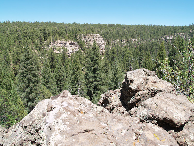
One of the Box Canyon ruins


Over the next few days, I'll be chronicling my one-day
hike-drive in Wupatki National Monument and Sunset Crater National Park. This
two-park tour is famous for its multi-cultural Native American ruins, volcanic
geology and outstanding Painted Desert views. Also, the park's 2,000-foot
elevation variance blends desert scrublands, rich pine forests, sandstone mesas
and rivers of lava for perhaps the most complex cluster of hiking trails in
Arizona. 


Lomaki Pueblo


Using the 35-mile "volcanoes and ruins loop road” north
of Flagstaff as the main travel artery, I made six stops for short hikes
totaling 4.25 miles.  First up:
Lomaki Pueblo & Box Canyon.  Located
at the north end of the park on the high plains of the San Francisco Volcanic
Field, this collection of red-sandstone ruins built on a gaping earth crack
have not been restored, so visitors can marvel at the precision architecture
and mortar work that has held up for more than 800 years.  Three main structures teeter on the
edge of a narrow box canyon where the original inhabitants may have farmed and
used imaginative technology to harvest rain water.  Interpretive signs along trail augment the hike with
insights into pertinent archeological research.


Box Canyon ruins


LENGTH: 0.5-mile loop


RATING: easy (non-paved, some steps)


ELEVATION: 5,325'-5,350'


GETTING THERE:


From Flagstaff, travel north on US 180 to milepost
444.5 (north entrance to the parks).  Turn right and continue 4
miles to the Lomaki turn off on the left. Roads are 100% paved.


FACILITIES: restroom, picnic table


HOURS: open year-round sunrise to sunset


FEE: $5 per person, good for 7 days at both Wupatki and
Sunset Crater


PETS: are not allowed on any park trails or in buildings.  Please do not leave pets in cars---heat
can be fatal, even on cool days.


INFO: National Park Service, 928-679-2365


MORE PHOTOS:


Thursday, July 26, 2012

Hike and swim at Red Rock Crossing


RED ROCK CROSSING


Crescent Moon Ranch, Sedona


A gigantic sycamore shades Oak Creek


Ancient spirits are rumored to inhabit
the rusty-red landforms that soar above this enchanting, cottonwood
and sycamore-shaded bend in Oak Creek Canyon. That’s because, in
addition to being one of the most photographed locations in the
world, Red Rock Crossing also is one of Sedona’s vortex
sites—places on earth noted for their high spiritual energy. The
area’s beauty and cooling waters attract religious pilgrims,
tourists, and those who just want to enjoy majestic views and cool
breezes along the creek. Many of the trails in the park are stroller
and wheelchair-accessible while shaded ramadas, restrooms, access to
swimming holes, water chutes and fly fishing combine for a memorable,
family-friendly daytrip.


Himalaya-Berry


PLANT PROFILE:


Himalaya-Berry (Arizona blackberry)


Rubus procerus


Habitat: introduced species found
mainly in Oak Creek Canyon and Grand Canyon NP


Elevation: 4,000 – 6,000 feet


Blooms: June


Berries: summer


Lush riparian greenery flanks the creekside trail


HIGHLIGHTS: kid-friendly, water play,
some barrier-free trails, picnic armadas, world-famous views


LENGTH: 2 miles roundtrip (for the
unpaved creek walk)


ELEVATION: 4,000 feet


RATING: easy


DOGS: dogs must stay on leash and
out of the water


DISTANCE FROM PHOENIX: 125 miles one way


GETTING THERE:


Drive west from
Sedona on AZ 89A to Upper Red Rock Loop Road (Forest Road 216) and
follow the signs to Red Rock Crossing.


FEES: $10 daily fee per vehicle


INFORMATION: Red Rock Ranger District
(928) 282-4119, http://www.fs.fed.us/r3/coconino/recreation/red_rock/crescentmoon-picnic.shtml


June 26th plane crash closes 2 Sedona trails


Airport Loop and Table Top Trails in Sedona are temporarily closed due to an airplane crash that occurred this morning.  Please contact the Red Rock Ranger District or the Coconino National Forest web site before planning a hike here.

http://www.cnn.com/2012/07/26/us/arizona-plane-crash/index.html?hpt=hp_t2

Red Rock Ranger District: 928-203-7500

http://www.fs.usda.gov/recarea/coconino/recreation/hiking/recarea/?recid=71905&actid=50


Tuesday, July 24, 2012

Your guide to summer WATER recreation


PHOENIX MAGAZINE AUGUST 2012 ISSUE


Hi Hikers (anglers, boaters, tubers...), pick up a copy of the August PHOENIX magazine for my story about AZ summer water recreation.  You'll find 71 ideas for hiking, boating, fishing, camping, kayaking and just about anything (gold panning, anyone?) else pertaining to outdoor water recreation. 


ON
SALE AUGUST 26, 2012


Here’s
where you can find PHOENIX magazine:

Safeway, Fry’s Marketplace, Wal-Mart, Costco, Sam’s Club,
Sunflower Markets, Sprouts, Borders, Barnes & Noble, CVS,
Walgreens, Sky Harbor Airport, Albertson’s, Fresh & Easy,
Lowe’s, Home Depot, Target, Whole Foods, Basha’s, A.J.’s, La
Grande Orange, The Kitchen, Area hospital gift shops
WEB
SITE: http://www.phoenixmag.com/ ORDER BY PHONE: 480-664-3960


Sunday, July 22, 2012

Descend a rocky road to East Clear Creek


MACK’S CROSSING


Coconino National Forest


Since it was abandoned in the 1940s, the old road leading to
Mack’s Crossing has disintegrated into a precipitous ledge overlooking the
gaping gorge carved by


East Clear Creek.


Even though the rough conditions don’t deter brave souls in
fishing-gear-laden ATVs from careening down the serpentine route-- hiking at a
leisurely pace is the best way to savor the  epic beauty of this dramatic
canyon.


The downhill trek to the creek begins on the sunny edge of
the Mogollon Rim, passing fossiliferous limestone outcroppings and a stand of
elegant Arizona walnut trees before rounding a bend where grand views of the
waterway 600 feet below grab the spotlight.


East Clear Creek


Near the creek, thickets of wild roses, alders, and exotic
wildflowers color the landscape and provide handy excuses to stop and take in
the sights.  Although the official
trail ends where the road meets the sandy shore of the shallow stream,
opportunities for wading, swimming and fishing abound both up and downstream.


Antelope Horns


PLANT PROFILE:


Antelope Horns


Asclepias asperula


Habitat: 
woodland clearings and open areas


Elevation: 3,000 – 9,000 feet


Blooms: April-August


LENGTH:  4 miles
(on trail)


ELEVATION: 6,250 – 6,860 feet


RATING: moderate


DISTANCE FROM PHOENIX: 
165 mils one-way


GETTING THERE:


From the junction of AZ 89 and AZ 260 in Payson, go north on
89 past Clint’s Well to milepost 304.5 and turn right onto Enchanted Lane
(Forest Road 319).  Continue .2
miles to Green Ridge Dr., hang a right and go .5 miles to Juniper Dr. From
here, turn right and go a short distance to Cedar Dr. and follow it to the
“primitive road 137” sign.  Park
along the road—do not block private driveways.


INFORMATION: refer to the Coconino National Forest map


MORE PHOTOS:


Wednesday, July 18, 2012

Hike to a volcanic lake


WALKER LAKE


Coconino National Forest


Walker Lake


This expansive swale is a photographer’s paradise--especially since the couple of monsoony weeks we've had have coaxed out the wildflowers.  The combination of great views,
reflecting pools, abundant wildlife and a carpet of colorful summer blooms provides
unlimited photo opportunities. 
Acres of wild field mint, daisies, silverweed and New Mexican vervain,
lace the air with a refreshing herbal aroma.  In summer this ephemeral lake--which is an eroded volcanic crater--- shrinks to a patchwork of shallow pools with
clumps of water smartweed lilies bobbing on the surface. The rim of the cinder
cone forms a high fortress around the lake, giving a real sense of being inside
an extinct cinder cone. On the eastern horizon, the lofty pinnacles of the San
Francisco Peaks touch the sky. To add length and more interest to the hike,
scramble up to the crater’s rim with a pair of binoculars to scope out the elk,
deer, bear, porcupines and prairie dogs frequent this reliable water source.


San Francisco Peaks


LENGTH: 1-mile roundtrip


RATING: easy


ELEVATION:  8,060' - 8,189' 


DRIVING DISTANCE FROM PHOENIX: 175 miles


GETTING THERE:


From Flagstaff, go 19 miles north on  US180  to the
northern exit for Forest Road 151 (Hart Prairie Road) just past milepost
235.  Turn right and continue 1.6
miles on the good dirt road to Forest Road 418.  Turn left and go .2 mile to the second road on the left
(across from a log cabin).  Go left
onto this unmarked dirt road, continue a short distance to a 3-way roundabout
and then go right to the circular parking area.  The trail begins at the “road closed” sign in the northwest
end of the parking area.


New Mexican vervain


INFORMATION: (928) 526-0866,
or refer to the Coconino National Forest map


Monday, July 16, 2012

Fossil Creek closure to be lifted Wednesday


From: "Harper, Stephen -FS" <sharper@FS.FED.US>

Date: July 16, 2012 2:44:18 PM PDT

To: <USDA-FS-NEWS@NEWSBOX.USDA.GOV>

Subject: SOUTHWESTERN-NEWS-RELEASE: Coconino National Forest Smoke Information


Flagstaff, AZ –
Campfire
and smoking restrictions, as well as the Fossil Creek area closure,
will be lifted on the Coconino National Forest beginning Wednesday July 18, 2012 at 8
a.m.


Recent
rains, along with higher humidity and increased fuel moistures, have
lowered fire danger on the forest and decreased the risk of major
wildfires.


 “Although
campfires will be allowed throughout the forest, people should never
leave a campfire unattended,” said Coconino Fire Staff Officer Russ
Copp. “Campers
should make sure they bring about five to six gallons of water to
extinguish their campfire completely before leaving, making sure to stir
it with a shovel as you are pouring the water. The fire pit should be
cold to the touch before leaving the campsite.”


Forest
visitors are also reminded that campfire restrictions may vary on
different national forests. Please call the nearest land management
office or 877-864-6985
for current information or see
http://www.publiclands.org/firenews/AZ.php online.


For additional information please see
www.coconinoforest.us or call the Coconino National Forest at 928-527-3600. 


Thursday, July 12, 2012

Hiking in Arizona's Bigfoot territory


BEAR CANYON LAKE


Apache-Sitgreaves National Forest


Attention all Bigfoot seekers---this
is your trail. Whether you take the existence of the reclusive beast
with relish or a grain of salt, know that many alleged  sightings in Arizona have occurred in the forests surrounding Bear
Canyon Lake.


Even with boisterous crowds of campers,
anglers and hikers flocking to this popular summer destination--the
beast abides. So, you’ll want to come prepared with binoculars,
video camera and---for serious seekers---supplies for making plaster
casts of footprints. However, finding the shy beast can be a
challenge, even for cryptozoologists--those
who study legendary or “hidden” creatures. That’s because the
thick pine-oak woodlands surrounding the lake provide ample hiding
places and dense undergrowth makes exploring a major endeavor. In
the event Bigfoot fails to make an appearance, there are still
plenty of other attractions on this high country trek. A scenic
aspen-ringed peninsula, bald eagles, elk and secluded,
moss-embellished coves make this a worthy hiking trail---even without
scoring a peek at the mysterious creature lurking among the pines.


Red Cinquefoil


PLANT PROFILE:


Red Cinquefoil


Potenilla thurberi


Habitat: loamy soil, pine forests


Elevation: 6,000 – 9,000 feet


Blooms: July-October


LENGTH: 2 miles round trip (on main
trail)


ELEVATION: 7,560 – 7,500 feet


RATING: easy


DISTANCE FROM PHOENIX: 147 miles
one-way


GETTING THERE: From the junction of AZ
87 and AZ 260 in Payson, go east (right) on 260 for 30 miles to Rim
Road (Forest Road 300). Turn left and continue west on FR300 for 12
miles to Forest Road 89, turn right and go 3 miles to the lake.


The last 14 miles are on good dirt
roads. The trail goes downhill from the parking lots 0.25 miles to
the lake where it continues along the shore in both directions.


INFORMATION: Black Mesa Ranger District
(928) 535-7300, http://www.fs.fed.us/r3/asnf/recreation/black_mesa_trails/trl_chv_bearcanyon.shtml


Wednesday, July 11, 2012

Monsoon insurance in a bag


BHEESTIE Bags dry out soaked personal electronics


It happens to me all the time---a summer monsoon storm hits while
I'm hiking in Arizona's high country and suddenly, my little point-and-shoot
camera fogs up. It has a tendency to collect consensation when exposed to cool
moisture especially after being used at 80+ degrees just moments before. This
not only makes the lens hazy, but also can damage the electronics. Used to be,
when this happened, I'd shut the camera off for a few days and hope for the
best--sometimes the gamble paid off, sometimes not.  So, when two sisters from Oregon contacted me about field
testing their BHEESTIE dry-out bag invention---I was all in on that! The
product is a pouch filled with moisture-absorbing beads that pull away
water, fog or whatever other wet stuff has gotten into your camera, cell phone,
iPod, watch or GPS devise. The feather-light, flat bags fit easily into a
backpack and are way more effective at drying out electronics than the
"old rice-in-a-ziplock-bag trick" (or doing nothing) and can be
re-used for up to a year.  Although
there's no 100% guarantee that a BHEESTIE can save your drenched devise, having
one handy is like  cheap insurance
for that $400 smart phone.  It did
work on my monsooned Nikon Cool Pix camera. 


Available online and at REI


getdry@bheestie.com


DISCLOSURE: I was provided a free BHEESTIE bag to field test
with no obligation to publish a positive review. 

Monday, July 9, 2012

Cool & easy Flagstaff summer hike


ARIZONA TRAIL from SCHULTZ TANK Day Hike


Coconino National Forest


Passage 34 of the Arizona Trail runs through 36 miles of
stunning high country territory beginning in the cool pine forests around
Schultz Tank and ending on the arid scrublands near Cedar Tank Ranch. With
numerous easy-access trailheads, it's a cinch to hike this passage in a series
of short day hikes like the one we did last Saturday. Beginning at the Schultz
Tank/Weatherord trailhead, our objective was to do a 7-to-10-mile, out-and-back
trek.  About 50 yards up the
Weatherford trail a nice wood sign marks where the AZT heads left and also
states that it crosses the Moto Trail at 3.5 miles. Given that the sky was
churning with ominous storm clouds, this sounded like a do-able turnaround point.
As it turns out, there's no sign at the Moto junction (although some graffiti
points the way to Snowbowl and So. Flagstaff).  Because the trail is so flat and easy (and the rain clouds
were dissipating), we decided to continue hiking. It's at about this point
where the mountain bike traffic really picks up.  That's because the Moto trail connects with the Fort Valley
Trails System---another favorite of bikers.  And its easy to see why--the relatively new trail is smooth,
free of rocks and full of long hairpin turns gliding through fern gullies,
fields of lava boulders and coniferous forests.  The route crosses several dirt service roads and various
off-the-maps mountain bike trails (a biker who stopped to chat identified one
as the "Dog Food" trail) as it gradually climbs up to the aspens
along Snowbowl Road--a good turnaround or car shuttle point.


LENGTH: (all one-way from Schultz Tank)


to Moto Trail junction: 3.5 miles


to Kachina trailhead: 7.6 miles


to Snowbowl Road: 7.8 miles


RATING: easy-moderate


ELEVATION: 


to Moto: 8020'-8800'


to Kachina: 8020'-9321'


to Snowbowl Road: 8020' - 9310'


KID FRIENDLY: yes


BEST SEASON: May thru October


DISTANCE FROM PHOENIX: 155 miles


GETTING THERE:


Schultz Tank Trailhead:


From Flagstaff, travel north on US180 (Fort Valley Road) to
milepost 218.6 and turn right on Schultz Pass Road (FR420).  Follow FR420 0.7 mile to a fork, veer
left to stay on FR420 and continue 4.8 miles to the Schultz Tank/Weatherford
trailhead on the right. Schultz Pass Rd is bumpy dirt-- passable by sedans but high clearance is recommended.


Snowbowl Road /Humphreys Trailhead:


From Flagstaff, travel north on US180 (Fort Valley Road) to
milepost 223, turn right onto Snowbowl Road and continue 4.2 miles to the
trailhead on the left. Roads are paved all the way to the parking lot.


INFO:


MORE PHOTOS:

Friday, July 6, 2012

Guided Arizona Trail hike: July 14, 2012


WALNUT CANYON GUIDED HIKE


Coconino National Forest


Have you been wanting to step out onto
state-traversing Arizona Trail, but don't know how to begin? Say, here's an idea-- how about taking a moderate stroll with ranger Jane along an historic
passage above Flagstaff's Walnut Canyon. In addition to enjoying a
cool hike in the pines, you'll learn a thing or two (or ten) about
the geological and human history of the canyon.


DATE: Saturday, July 14, 2012, 9:00
a.m.- 1:00 p.m.


LENGTH: 5 miles roundtrip


ELEVATION: approx. 6600'-6400'


RATING: moderate


INFO & REQUIRED EQUIPMENT:

Thursday, July 5, 2012

Easy water hike near Greer


PONDEROSA LOOP


Squirrel Spring Recreation Area


Fed by three gurgling mountain streams
and located adjacent to several campgrounds, Squirrel Spring
Recreation Area is a popular, year-round playground with ample
parking, picnic tables and restrooms. With over 14 miles of multi-use
trails, this destination offers easy hiking among gigantic Ponderosa
pines, bramble-choked creeks and glades. A good introduction to this
trail system is the Ponderosa Trail #2.


Like a walk through the mythical
earthly paradise of Shangri-La, the path wanders through a
grassy-green valley enveloped by rolling hillsides and abrupt, stony
escarpments. The route is somewhat befuddling, so, here’s the
plan: From behind the trailhead kiosk, walk a quarter-mile on the
wide, old road to a large metal gate. Pass through the gate and
continue uphill to a junction at roughly the 1.5 mile point. Stay on
trail #2. The trickiest intersection comes at mile 1.7 where there’s
a small “#2” sign posted on a tree on the left. Here’s where
you’ll leave the wide road and use the blue diamond symbols as your
guide to complete the loop.


HIGHLIGHTS: easy hiking with lots of
greenery and nearby campgrounds


LENGTH: 3.5-mile loop


RATING: easy


ELEVATION: 8,300 – 8,700 feet


DRIVING DISTANCE FROM PHOENIX: 237
miles


GETTING THERE:


From the stoplight in Eagar, go west on
AZ260 for 9.6 miles to AZ373. Go south (left) on 373 and
continue 2.2 miles to the Squirrel Spring Recreation Area on the
right.


Monday, July 2, 2012

Canyon Fire closes AZ87 today

Highway 87  north of the Blue Ridge area and in the vicinity of Jack's Canyon on the Mogollon Rim is closed today.  Please check with the forest service before heading out to the area.


http://www.fs.usda.gov/detail/coconino/news-events/?cid=STELPRDB5377713

Sunday, July 1, 2012

Steep hike to West Clear Creek

TRAMWAY TRAIL


West Clear Creek Wilderness


Contained within the striated walls of a remote canyon on
the Mogollon Plateau is the most expressive example of what might happen if the
powerful hand of Nature applied a sledgehammer to a mesa and filled the
resultant wound with water.


Narrow and deep, the rough-hewn upper reaches of West Clear
Creek are a maze of cracked and tilted tributary slot canyons scoured out of
contorted layers of sedimentary rocks. From its headwaters on the Mogollon Rim,
the creek rips through a riparian gallery forest before merging with the Verde
River 40-miles downstream.  The
Tramway Trail #32, which offers the easiest access to this pristine wilderness,
begins on the cliffs overlooking the canyon.  Here, remains of a defunct cable tram that was used from
1942 to 1965 to stock the creek with trout, hangs in rusted knots from an
enormous Ponderosa pine tree. The route into the canyon is a spider crawl along
a thin trail that clings to the siltstone precipice like a rocky fire escape.
For those who are not bothered by heights, this trail’s steep switchbacks,
rock-scrambles and dizzying drop-offs deliver a substantial adrenaline-rush.


At the base of the trail, there’s a well-worn primitive
campsite above a large pool of water where healthy tufts of Canada violets and
ferns sprout from the loamy soil. 
Although the campsite marks the official end of the trail, adventurous
hikers can pick their way along the creek through thick, wildlife-rich
woodlands.  At every bend in the
stream, contorted, 800-foot-high canyon walls converge and seem to swallow up
the sky only to release it as seldom-seen alcoves emerge from beyond the clutch
of the stony precipice.


LENGTH: 1 mile round-trip (on trail) with exploratory options


RATING: moderate


ELEVATION:  6,650’
– 5,900’


DISTANCE FROM PHOENIX: 
150 miles one-way


GETTING THERE:


From Phoenix, go north on I17 to the AZ 260 interchange near
Camp Verde. Go east on AZ 260 (General Crook Trail) to the junction with AZ
87.  From there, go north (left)
and continue for 11 miles to Lake Mary Road (Forest Road 3).  Go north (left) on Lake Mary Road and
continue for 7.5 miles to FR 81. 
Turn west (left) onto FR 81 and drive 3 miles to FR 81E.  Follow FR 81E and the “Tramway Trail”
and generic “trail” signs for 3.6 miles to FR 693.  Go west (right) on FR 693 and continue 1.2 miles to a fork
in the road.  Turn left at the fork
and drive less than a half-mile to the trailhead.  A high-clearance vehicle is required.


INFO: Coconino National Forest,  Mogollon Rim Ranger District (928) 477-2255

http://www.fs.usda.gov/recarea/coconino/recreation/hiking/recarea/?recid=55416&actid=50


MORE PHOTOS: