We got lost, so you don't have to. 400+ TRAILS. Search for hikes using the TRAIL INDEX on the left side of my blog roll. Happy Trails!
Thursday, May 31, 2012
National Trails Day: June 2, 2012
Sign up to participate in one of the many National Trails Day events scheduled for this Saturday, June 2, 2012.
There are hikes, maintenance projects and ranger-led educational opportunities being offered statewide. Check out this link to find an Arizona event near you:
http://www.americanhiking.org/NTDSearchResult.aspx?sId=3
Tuesday, May 29, 2012
Kaibab National Forest seeks volunteers for trail work
JUNE 16-17: ARIZONA TRAIL MAINTENANCE VOLUNTEERS NEEDED
Kaibab National Forest |
FROM: Jacqueline Banks, Public Affairs Officer, Kaibab National Forest
TUSAYAN,
Ariz. – The Kaibab National Forest and the Arizona Trail Association
are seeking volunteers to assist with maintenance of the Arizona
National Scenic Trail
on the Tusayan Ranger District June 16 and 17.
Volunteers
will conduct trail maintenance on the Coconino Rim section of the trail
between Russell Tank and Grandview Lookout. Work will include clearing
fallen
trees, trimming tree limbs, cleaning water drainage features, and
removing rock, pines needles and other debris from the trail.
Any
person interested in volunteering is welcome. Those under age 18
should be accompanied by an adult. Trail work will take place all day
June 16 and until noon
on June 17. Volunteers are invited to camp on the Tusayan Ranger
District at the junction of forest roads 310 and 302 on the nights of
June 15 and 16, if they so choose.
The
Kaibab National Forest and Arizona Trail Association will provide tools
and hard hats. A large water tank will be available at the campsite.
Volunteers should
bring food, snacks, day pack, and appropriate clothing. Leather boots
are encouraged, but closed-toe shoes are required. Pants and
long-sleeved shirts are recommended.
The
Arizona National Scenic Trail is a continuous, 800+ mile diverse and
scenic trail across Arizona from Mexico to Utah. The Arizona Trail
Association’s mission
is to build, maintain, promote, protect and sustain the trail as a
unique encounter with the land.
Individuals
interested in volunteering should contact Joe Welke, Tusayan Ranger
District, at (928) 635-8219, or Tom Coulson, Arizona Trail Association,
at (480)
326-0459.
Sunday, May 27, 2012
Hiking among aspens on the Arizona Trail
Bismarck Lake to Geyler Tank
Arizona Trail Passage #34
Bismarck Lake May 26, 2012 |
Although it's fun to hike previously untried trails, there
are a few that have commandeered my soul---keeping me coming back again and
again. Bismarck Lake is one of
those trails. A breathtaking, thin air trek beneath the San Francisco Peaks,
the trail cuts through damp forests of Limber pines, aspens and Douglas firs
with intermittent meadows splattered in manic wildflower colors. Just before encountering the lake, the
trail emerges abruptly from the woodlands onto an expansive prairie with views
of the peaks soaring 3000 feet into the clouds. Here, mountain-borne breezes muddled with crisp, coniferous
perfumes rage over knee-high grasses prompting countless hat-holding photo
moments. I could stand here for hours,
soaking up what is--for me--a perfect place. Within a few yards after entering the prairie, a sign points
to a short spur path leading to the lake. As with most volcanic
lakes---Bismarck is an eroded cinder cone crater---this one vacillates from a medium-size
pond to muddy puddle, and yesterday, it was virtually non-existent. Still, the side trip pays off with
patches of water-loving blooms and animal footprints including elk, deer,
raccoons and bear. To extend the
hike, head back to the sign and continue 0.2 mile east to the Arizona Trail
junction. On past trips, we've
headed right (south) and hiked through an aspen wonderland to Snowbowl Road, so
this time, we headed left with the objective of hiking out-and-back to Geyler
Tank. We did this on May 26, 2012, an unseasonably cool, very windy day. Temperatures for the day were 37-50
degrees with 40 mph wind gusts---heaven!
Here’s what we did:
From the trailhead, hike 1 mile to Bismarck Lake
junction. A short spur trail heads
to the water, but we skipped the trip because there was no water in the
lake. From the lake, follow the
trail east another 0.2 mile to the AZT junction. Turn left (north) and continue 4 miles to FR418, cross the
road and hike less than a mile to a large meadow west (left) of the trail at
the base of an old volcano (Walker Lake is inside). Geyler Tank is located 0.2
miles west of the trail.
LENGTH: 12.2 miles roundtrip
RATING:
easy
ELEVATION: 8,500' - 8900'
GETTING THERE:
From Phoenix, go north on I17 to Flagstaff. Connect with US180 and travel 10.2
miles north to milepost 225 and turn right onto Hart Prairie Road (FR151). Follow FR 151 6.4 miles (passing by the
Nature Conservancy) to FR 627.
Turn right and continue 0.6 mile to the trailhead. FR 151 and FR 627 are
dirt and usually passable by sedan.
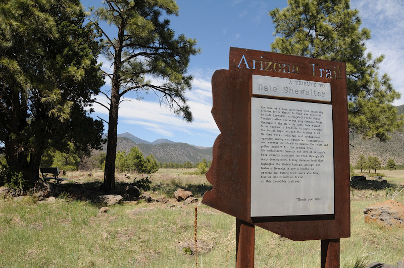
INFO: http://www.aztrail.org/passages/pass_34.html
MORE PHOTOS:
Thursday, May 24, 2012
Escudilla Mountain Wilderness re-opens for hiking this weekend
After being closed to public access since last year's devastating Wallow Fire, the Apache-Sitgreaves National Forest will re-open Escudilla Mountain Wilderness beginning this weekend.
However, the announcement also advises all entering the area to "look up, look down, look around" for stump holes, teetering snags and other dangerous post-blaze hazards.
UPDATED CLOSURE MAP, MAY 23, 2102:
http://www.fs.usda.gov/Internet/FSE_DOCUMENTS/stelprdb5369539.pdf
UPDATED CLOSURE ORDER:
http://www.fs.usda.gov/Internet/FSE_DOCUMENTS/stelprdb5324638.pdf
Escudilla Mountain Trail: August, 2006 |
However, the announcement also advises all entering the area to "look up, look down, look around" for stump holes, teetering snags and other dangerous post-blaze hazards.
UPDATED CLOSURE MAP, MAY 23, 2102:
http://www.fs.usda.gov/Internet/FSE_DOCUMENTS/stelprdb5369539.pdf
UPDATED CLOSURE ORDER:
http://www.fs.usda.gov/Internet/FSE_DOCUMENTS/stelprdb5324638.pdf
Gladiator Fire video tour
Here's an excellent video that details the progression of the Gladiator Fire near Crown King:
http://www.crownkingaz.com/archives/crown-king-gladiator-fire-day-9-update-2/
NEWS UPDATES, MAPS & PHOTOS:
http://www.prescottenews.com/news/current-news/item/19984-gladiator-fire-wednesday-26-containment-plus-maps-photos#axzz1vtiV5XM0
http://www.crownkingaz.com/archives/crown-king-gladiator-fire-day-9-update-2/
NEWS UPDATES, MAPS & PHOTOS:
http://www.prescottenews.com/news/current-news/item/19984-gladiator-fire-wednesday-26-containment-plus-maps-photos#axzz1vtiV5XM0
Monday, May 21, 2012
One trail--many loops
LOWER OLDHAM-ROCKY RIDGE-EASY OLDHAM LOOP
Coconino National Forest
Boulders on Lower Oldham trail May 19, 2012 |
Loop trails are the big thing in Flagstaff’s Elden
Mountain-Dry Lakes Hills area.
Every trail connects with another making for myriad hiking options,
especially on the west side which was spared from the 2010 Shultz Fire. Oldham trail #1 is an easy-to-access
route leading to some of the most scenic and heavily traveled loops—most
notably, the Brookbank and Sunset trails.
Pine, fir and oak trees shade much of the area and several experimental
forests and aspen regeneration projects add interest for kids and forest-loving
adults alike. With so many
choices, selecting an Elden-area loop hike is a tough decision but, this day, we
decided to connect with the Lower Oldham, Rocky Ridge and Easy Oldham trails.
Rocky Ridge trail |
Here’s what we did:
Begin at Buffalo Park and hike 0.5 mile straight thru to the Lower
Oldham trailhead—which is also a portion of the Arizona Trail (AZT). Hike 0.4 mile to the first junction,
veer right (northeast) and hike another 0.4 mile to the second junction at
Pipeline/Fatmans trail. Continue
hiking northeast (follow the AZT signs) for another mile to the third junction
where a sign for Rocky Ridge Access indicates that the AZT turns west (left) here. This will be the return part
of the loop, so continue 0.8 mile north (stay straight) to the big Lower Oldham
trailhead on FR557 (Elden Summit Road).
From here, cross the road, pick up Rocky Ridge trail and follow it 0.8
mile to the turnoff for Rocky Ridge Access/AZT---this will be a 3-way
junction. Your path is located
slightly downhill near a giant boulder.
Heading east, hike 0.3 mile back to Lower Oldham, turn right (south) and
retrace your steps back to Buffalo Park.
Mount Elden seen from Lower Oldham trail |
LENGTH: 7.1-mile loop
RATING: easy-moderate
ELEVATION:
7110’ – 7580’
DISTANCE FROM PHOENIX: 146 miles one way
DOGS: dogs must be on leash in Buffalo Park
KID FRIENDLY?: yes
BEST SEASON: late April - November
GETTING THERE:
From Flagstaff, travel north on Fort Valley Road (US180) to
Forest Ave. Turn left and continue
to the stop light at Gemini Drive.
Turn left and follow the signs to the park.
INFO & MAP: Flagstaff Ranger District, Coconino National
Forest, 928-526-0866
MORE PHOTOS:
Bill Williams Mountain Watershed closed to entry
Hi Hikers, fire season continues to take its toll on Arizona summer hiking destinations.
Due to extreme fire danger, Kaibab National Forest has decided to CLOSE TO ENTRY the sensitive watershed area around Bill Williams Mountain south of Williams as of May 21, 2012. This means no access to Bill Williams Mountain Trail, Benham Trail, Bixler Saddle and other surrounding routes.The closure is bounded by Perkinsville Road (CR73) on the east, south to FR122, west to FR108 and north to I40. Once the area has received sufficient rainfall, the forest service will consider re-opening access. CALL THE WILLIAMS RANGER DISTRICT BEFORE HEADING OUT TO HIKE. 928-635-5600
http://www.fs.usda.gov/recarea/kaibab/recreation/hiking/recarea/?recid=11653&actid=50
MAP:
http://www.fs.usda.gov/Internet/FSE_DOCUMENTS/stelprdb5317872.pdf
Gladiator Fire closes parts of Prescott National Forest
Hikers,
You should re-think any plans to hike Groom Creek, Wolf Creek, Poland Creek and Mt Union in the Bradshaw Ranger District. That's because the Gladiator Fire burning near Crown King is still raging and smoke is very heavy. Review the closure notice below and steer clear of the area!
(From the National Forest Service press release:) An expanded Closure Order is in effect, as of May 20, 2012 at 6 p.m., for all Prescott National Forest, Bradshaw Ranger District land south of the following: Beginning at the southwest corner, Township 12 North, Range 3 West, Section 33; south of River Pasture, along Forest Road 72 west to FS Road 667, following Middlewater Creek to the south of Maverick Mountain, east to Forest Road 9403C and onto Forest Road 52B connecting to the Senator Highway (County Road 56). Senator Highway east continuing to FS Road 261 east of Mount Union Lookout towards County Road 58 through Breezy Pines, extending to Poland Junction. All roads leading into the community of Crown King are closed. Cleator – Crown King Road (County Road 59) is closed at Cleator. Senator Highway to Crown King (County Road 52) is closed at the junction with Poland Rd. (County Road 58). Mayer-Bolada Road (County Road 177) is closed at the Forest Boundary. Forest Road 711 is closed south of the Forest boundary at Cow Creek Forest Road 362 is closed south of the Forest boundary at Wagner. Forest Road 192 is closed. A Yavapai County fire ban is in effect across all fire ban zones. Prescott National Forest Campfire and Smoking Restrictions are also in effect. For AZ Fire Info & Restrictions Information call 1-877-864-6985 or visit http://wildlandfire.az.gov.
You should re-think any plans to hike Groom Creek, Wolf Creek, Poland Creek and Mt Union in the Bradshaw Ranger District. That's because the Gladiator Fire burning near Crown King is still raging and smoke is very heavy. Review the closure notice below and steer clear of the area!
View of the Bradshaw range from Spruce Mtn lookout |
(From the National Forest Service press release:) An expanded Closure Order is in effect, as of May 20, 2012 at 6 p.m., for all Prescott National Forest, Bradshaw Ranger District land south of the following: Beginning at the southwest corner, Township 12 North, Range 3 West, Section 33; south of River Pasture, along Forest Road 72 west to FS Road 667, following Middlewater Creek to the south of Maverick Mountain, east to Forest Road 9403C and onto Forest Road 52B connecting to the Senator Highway (County Road 56). Senator Highway east continuing to FS Road 261 east of Mount Union Lookout towards County Road 58 through Breezy Pines, extending to Poland Junction. All roads leading into the community of Crown King are closed. Cleator – Crown King Road (County Road 59) is closed at Cleator. Senator Highway to Crown King (County Road 52) is closed at the junction with Poland Rd. (County Road 58). Mayer-Bolada Road (County Road 177) is closed at the Forest Boundary. Forest Road 711 is closed south of the Forest boundary at Cow Creek Forest Road 362 is closed south of the Forest boundary at Wagner. Forest Road 192 is closed. A Yavapai County fire ban is in effect across all fire ban zones. Prescott National Forest Campfire and Smoking Restrictions are also in effect. For AZ Fire Info & Restrictions Information call 1-877-864-6985 or visit http://wildlandfire.az.gov.
Saturday, May 19, 2012
Sunflower and Gladiator Fires visible from space
Gladiator Fire as seen from I17, May 19, 2012 |
If you can see them from space, they must be big.
Groan. I'm having flashbacks from last year's Wallow Fire. Check out the NASA site below:
http://earthobservatory.nasa.gov/NaturalHazards/view.php?id=77944
Wednesday, May 16, 2012
Barrier-free hiking on Flagstaff's McMillan Mesa
McMILLAN MESA
Flagstaff Urban Trails System/Arizona Trail
I've decided to call this one a sandwich hike. Like the
great American lunch staple, the good stuff of this trek happens in the middle
while the scenic equivalent of white bread bolsters the fringes. The hike takes off near the main
entrance of Buffalo Park, swinging south onto a route that's now part of the
most urban passage of the Arizona Trail where there's a large sign with a
tribute to Flagstaff educator and trail founder, Dale Shewalter. Within a few yards, the trail crosses
over Cedar Avenue on Matt Kelly bridge--which is named for a young bike rider
who was killed by a drunk driver.
Past the bridge there's some serious ugly---a power plant
and quarry. Still, this is billed as an urban trail, so I guess I don't have a
complaint coming. Farther along, the wide, gravel route crosses McMillan Mesa--
the good stuff-- a grassy ridge sandwiched between downtown and the upper
eastside of Flagstaff. Sparsely
populated with junipers, pines and firs, the view to the southeast is
surprisingly lovely. To the
northeast, the busy city sprawls and carries on below. The trail is suitable
for strollers, wheelchairs and walkers, making this a popular choice for
multi-generational families. Also,
benches are placed at scenic spots along the way, including one that's perfect
for train-spotting the BNST railroad that parallels Route 66.
LENGTH: 1.5
miles one-way
RATING: easy, stroller-friendly, barrier-free
ELEVATION: 7,040'
DOGS: leashed dogs allowed
KID FRIENDLY?: yes
GETTING THERE:
Buffalo Park (North):
From Flagstaff, travel north on Fort Valley Road (US180) to
Forest Ave. Turn right and continue
to the stop light at Gemini Drive.
Turn left and follow the signs to the park.
Hemlock Way (south):
From Flagstaff, travel east on Route 66 to Switzer Canyon
Road. Turn north (left) and go 0.6
mile to Turquoise Drive, turn right, go 0.3 mile to Ponderosa Pkwy, turn right
and go 0.5 mile to Locust, turn left and go 0.1 mile to Apple, turn right and
go 0.1 mile to Hemlock, turn left and continue 0.1 mile to the trailhead.
INFO: City of Flagstaff
Arizona Trail Association
MORE PHOTOS:
Tuesday, May 15, 2012
Sound off on how AZ recreation dollars should be spent
Help improve Arizona's outdoor recreation by participating in the Statewide Comprehensive Outdoor Recreation Plan (SCORP) Survey.
The survey seeks to learn about the preferences and needs of people--like hikers--who recreate on Arizona's public lands. Results will be used by outdoor recreation managers on policy and funding matters.
It takes about 25 minutes to complete.
Take the survey at http://surveymonkey.com/s/SCORPpub
(Note: The survey closes May 31, 2012)
For more information on SCORP and the planning process, visit http://azstateparks.com/publications/#SCORP2012.
Monday, May 14, 2012
InciWeb--your source for wildfire updates
Mazatzal Mountains south of Payson |
We all knew this was coming---wildfire season. With 5 blazes already in progress on our public lands, my head is spinning. Some of these fires will actually do some good for forest health, others, not so much.
Right now it appears that the Sunflower Fire is the one closest to a major hiking trail---the Saddle Mountain and Mazatzal Divide passages of the Arizona Trail. It's burning west of AZ 87 north of Mount Ord and south of Mazatzal Peak. If you hiked in there, you know how remote it is---and, back in 2005, the Cave Creek Complex Fire also torched parts of this same area. Moving forward---its always a good idea to check for wildfire activity before heading out on a summer hike. InciWeb is an excellent resource with maps and is updated frequently.
Here's the link to the Sunflower Fire: http://www.inciweb.org/incident/2861/
Here's the link for ALL current AZ fires:
http://www.inciweb.org/state/3/
Wednesday, May 9, 2012
Legions of lizards on Ledges Trail #138
LEDGES TRAIL
Mormon Lake near Flagstaff
View from the ledges, May 5, 2012 |
Short in length but long on scenic beauty, this easy trek
climbs to a stone outcropping overlooking Mormon Lake. For fans of wildlife
viewing, the "ledges" are a terrific platform for spotting elk, waterfowl,
raptors and other large game. In
addition, legions of leapin' lizards, loquacious loggerhead shrikes, screeching
Stellar's jays and butterflies a plenty keep things interesting along the
trail.
The hike begins at site #25 in Dairy Springs campground,
ascending gently but with loose rock underfoot. Alligator juniper-framed first views of the lake emerge near
the 0.3-mile point where the route levels out amid lava-boulder-strewn fields
of wildflowers. This environment
is prime lizard habitat---they are everywhere. At one point, so many of the
little creatures were darting across the path, I though I had interrupted some
sort of reptile fly catching convention or something. Lucky for me, lizards can
be excellent photo models--they freeze when cornered. The path meets the "ledges" at the 0.6-mile
point. Here, lake vistas are
breathtaking. I saw a wandering
herd of elk waaaay in the distance and chided myself for not bringing
binoculars. From the ledges, the trail heads
left and downhill along a quagmire of footpaths passing several private
homes. Just pick a path---they all
lead to Mormon Lake Road where you can return the way you came or hang a right and walk back to the parking lot.
LENGTH: 1.5 miles one-way
RATING: easy
ELEVATION: 7,237' - 7,400'
DOGS: leashed dogs allowed
KID FRIENDLY?: yes
BEST SEASON: April-November
DISTANCE FROM PHOENIX: 167 miles
GETTING THERE:
From Phoenix, take I17 north to exit 339 for Lake Mary Road
(FR3) located south of the I40 interchange just before entering Flagstaff. Follow Lake Mary Road south (right)
20.6 miles to Mormon Lake Road (milepost 323.6), turn right and drive 3.7 miles
to the turn off for Dairy Spring campground. Turn right again and go roughly 0.2 mile to the
"trailhead parking" on the right or continue another bumpy/rocky 0.1mile
to the Mormon Mountain trailhead.
Trailhead parking areas are free, but if you park in the campground,
you'll be subject to fees. Hike
begins in the campground near site 25.
INFO: Flagstaff Ranger District, Coconino National Forest
MORE PHOTOS:
Friday, May 4, 2012
Six stock tanks and a herd of elk near Happy Jack
SHUFFS TANK
Happy Jack, AZ
Shuffs Tank, May 3, 2012 |
Maxie Tank |
Where there’s water, there’s wildlife and because of its numerous
stock tanks, natural pools and soggy drainages, animals tend to congregate on the
Happy Jack passage of the Arizona Trail.
Running 31.2 miles from AZ87 near the Blue Ridge ranger station to Lake
Mary Road near Allan Lake, this mild section of trail is a beautiful mix of
pine-oak forests and wide-open meadows.
Hoping to spot roaming elk and deer, we made an easy “stock tank” themed
out-and-back day hike on the northern part of this passage. Beginning at the Gooseberry Spring
trailhead (head southeast--right when facing the sign), the trail passes by six watering holes. All but two will likely vaporize by summer, but the two big
ones should survive the season.
The first water appears to the left of the trail in under a mile of
hiking and is little more than a natural shallow bog cluttered with water
buttercups. Tank number two is a
bulldozed depression dug out where the trail briefly follows a dirt road. Third water shows up as a tiny
grass-choked pond shortly before the trail encounters Maxie Tank---one of the
big ones. Less than a mile
farther, we met a local woman sitting near a deer blind on the far side of tank
number four. She is an avid
wildlife watcher and says that the best time to spot animals at the tanks is
between 7 a.m and 9 a.m. As it was nearly 10 a.m. when we arrived at tank four,
we wrote off seeing any elk on this trip.
At the 4-mile point is Shuffs Tank. Ringed by fragrant Ponderosa pines, wet meadows full of
wildflowers, and hundreds of animal footprints, this was by far the biggest of
the six tanks on our hike. Here,
thousands of Rocky Mountain irises are popping through the mucky swamplands
south of the tank---they should start blooming in next few weeks. We decided to
take a lunch break on the northwest shore, still hoping to spot animals. Up until then, our only sightings had
been the back end of a coyote, a mountain bluebird and thousands of gopher
burrows. (Do butterflies and ants count?) Then, on the way back,
about 2 miles from the trailhead, we hit pay dirt---a herd of 5 elk roughly
100 yards ahead of us. By some
miracle, Shortie the hiking dog had not spotted them and his handler was able
to leash him while I camera stalked.
Click on the “more photos” link below to see the beasts (and Shortie) in
action.
First water hole |
LENGTH: 8 miles out-and-back
RATING: easy
ELEVATION: 7,500’- 7,555’
KID FRIENDLY: yes, excellent choice
DOGS: water, wildlife--chasing!
GETTING THERE:
Gooseberry Spring trailhead:
From Phoenix, travel north on I17 to Camp Verde. Connect to SR260 east (Payson) and go
33.6 miles to SR87 (Beeline Hwy).
Turn north (left) and drive 10 miles to Lake Mary Road (FR3) which is
just past Clint’s Well. Turn
northwest (left) and follow Lake Mary Road 21.1 miles to FR 935 (signed
Gooseberry Spring), turn right and drive 0.2 mile to the signed AZT trailhead. Paved up to the last 0.2 mile. Passenger cars okay. For alternative directions, see "Four Gates" hike below.
INFO: Arizona Trail Association
MORE PHOTOS: