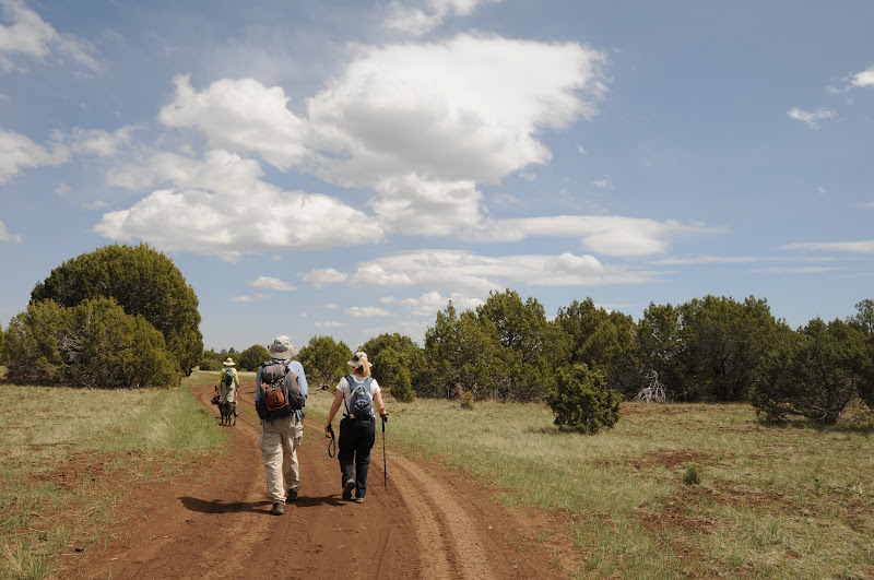
Monday, April 30, 2012

Allan Lake "four gates" hike

Passage #30 of the Arizona Trail, north of Clint’s Well


First gate


Four gates plus 15 minutes = 10 miles.  That’s the crazy equation we developed
for a pleasant, easy hike near Allan Lake.


Second gate


Third gate

We did this by following part of passage #30 of the
Arizona Trail (AZT) with a GPS to measure our mileage and we determined that
all one really needs to do to gauge a 10-mile out-and-back hike is count gates. Here’s the
plan.  From the trailhead, begin
hiking northwest (go left from the sign crossing the road) through a meadow
following the AZT sign posts. 
You’ll come to GATE #1 at the 0.5-mile point. Pass the gate, hike a few
yards and cross Lake Mary Road (FR 3) where GATE #2 greets you at 0.51 mile on
the west side of the road.  From
here, the trail parallels FR 3 for a short distance before meeting GATE #3.
Here, the signage is a bit confusing. The AZT sign points away from the gate,
as if instructing you to go left. However, the correct route goes through the
gate, (not around as the sign seems to indicate), and you’ll encounter another
AZT sign near a dirt road. Cross the dirt road, hang a right after a few feet
and follow the old railroad bed heading north.  This section passes the marshy headwaters of Allan Lake. You
won’t see any AZT signs for a while, but they will appear again at critical
junctions, so stay alert.  Once we
passed GATE #4, we hiked for another 15 minutes or so to make an even 5 miles.
As with all gates on forestlands---close them behind you --unless signage
instructs otherwise.


LENGTH: 10 miles roundtrip


RATING: easy


ELEVATION: 
7,450’-7,500’


THE RULES: non-motorized use only


DOGS: leashed dogs ok


KIDS:  good
choice


Fourth gate

DISTANCE FROM PHOENIX: 130 miles one-way


GETTING THERE:


ALLAN LAKE (a.k.a. Gooseberry Spring) TRAILHEAD:


From Phoenix, go 75 miles north on AZ87 (Beeline Highway) to
Payson.  At the intersection of
AZ87/260, continue north on AZ87 to Clint’s Well and turn left onto Lake Mary
Road (FR 3).  Continue 21.1 miles
on FR 3 to milepost 312.2, turn right (east) onto a gated dirt road for
Gooseberry Spring (FR 935) and drive 100 yards to the signed parking area on
the right.  Hike begins across the
road--head northwest toward the campground following the AZT signs. For alternative directions, see Shuffs Tank hike above. 


Sunday, April 29, 2012

Hiking Flagstaff's plateau lakes


HORSE LAKE


Mormon Lake Arizona Trail Passage 30


Elk skeleton in Horse Lake: April 28, 2012


Pinion pines and junipers on Anderson Mesa


Triple digit heat has arrived in the Valley and with it
comes the annual hiking exodus to higher elevations.  From October through April, we desert dwellers tend to
frequent hiking trails in an elevation range of 1,000-4,000 feet.  Come May--we migrate.  I don't know about you, but my first
few high elevation (7,000'+) hikes of the year leave me more breathless and more tired than
expected.  That's why I like to do a couple of easy ones first.  The mostly flat "plateau lakes" section of the
Arizona Trail-- commonly known as “Horse Lake”--fits this objective
perfectly.  Part of 33.9-mile
passage #30 of the Arizona Trail (AZT), this easy-to-access route wanders past
three ponds (Vail, Prime and Horse) on the pine-pinion-juniper shaded meadows
of Anderson Mesa northeast of Mormon Lake. These fugitive "lakes" vacillate
between hip-deep pools and soggy swales in sync with rainfall.  Regardless of water levels, the mesa
manages to stay moist enough to support plenty of flora and fauna.  In late April, the meadows begin blooming and yesterday, we found lots of Woodhouse phlox, stem-less
daisies and yellow spiny daisies. Most hikers prefer to do this as key-exchange
trek, parking vehicles at both the Marshall Lake and Horse Lake trailheads
meeting in the middle for a 10.5-mile one-way hike.  For our one-car day trip, we began at Horse Lake trailhead, hiked out
to Horse Lake and then doubled back. 
Easy. 


Hazy view of Flagstaff's  San Francisco Peaks


LENGTH: 7.6 miles roundtrip (as described here)


RATING: easy


ELEVATION: 7,090' - 7,142'


DOGS: leashed dogs allowed


BEST SEASON: Mid-April thru October


DISTANCE FROM PHOENIX: 160 miles one way


GETTING THERE:


Horse Lake (south) trailhead:


From Phoenix, travel north on I-17 to exit 339 for Lake Mary
Road located south of the I-40 junction


just before entering Flagstaff. Turn right and continue to
the bottom of the off ramp where there's a Circle store.  Turn right again and go 16.3 miles
south on Lake Mary Road (FR3) to milepost 327 and turn right on FR82E (Ashurst
Lake/Pine Grove).  The Horse Lake
trailhead is 0.7 mile ahead on the left.


Marshall Lake (north) trailhead:


From Phoenix, travel north on I-17 to exit 339 for Lake Mary
Road located south of the I-40 junction


just before entering Flagstaff. Turn right and
continue to the bottom of the off ramp where there's a CircleK store.  Turn right again and go 10.5 miles to
FR 128 on the left (signs say observatory--it's easy to miss).  Follow curvy FR 128 2 miles to the big
Marshall Lake sign/fence, turn left and continue less than a mile to the signed
AZT parking area.


INFO:


Arizona Trail Association:


Coconino National Forest, Flagstaff Ranger District: 928-526-0866


MORE PHOTOS:

Monday, April 23, 2012

Hike with bikes on Prescott's Circle Trail

COLD SPRINGS-POTTS CREEK-TRAIL 9401J


Prescott


April 21, 2012


Hikers beware, this Friday April 27 -Sunday April 29, 2012
is the weekend of Prescott's famous Whiskey Off-Road Bike Race.  This year, 1,750 mountain bikers have
registered and as the route follows busy downtown streets and popular hiking
trails alike, you may want to steer clear of the area if you prefer hiking with
less traffic.  We hiked a section
of the course this past weekend and encountered dozens of athletes practicing
for the race.  These trails are
part of the City of Prescott’s Circle trail system—a collection of national
forest, county and local trails, strung together in a 50-mile loop. From the
Aspen Creek trailhead, we began hiking on Cold Springs #393 which starts out
with an immediate uphill haul, then flattens out, wandering through  forests
of Ponderosa pines with many sunny clearings.  Soon, views of Prescott's Thumb Butte area pop out over the
trees.  Cold Spring--a damp rocky
depression---appears on the left just before the trail ends at the Potts Creek
#327 trail.  Trail 327 has lots of
ups-and-downs, staying close to the stream at first, but soon dives into the
woodlands through shady canyons, sun-washed meadows and a short burnt
section.  A three-way junction for
327-391-9401J presents many options. 
Continue on 327 to access myriad trails near Thumb Butte or (as we did)
take trail 9401J (unsigned, but it's the trail on the left denoted by a path of
logs) for a moderately strenuous, mostly exposed uphill haul to Sierra Prieta
Overlook


LENGTH:  11.3
miles out-and-back


Cold Springs #393: 
1.6 miles one-way


Potts Creek #327: 2 miles one-way


Trail #9401J: 2.3 miles one way


RATING: easy-moderate


ELEVATION: 6,200’- 6,940'


GETTING THERE:


Aspen Trail trailhead:


From the AZ69/89 junction in Prescott continue 1.25 miles
west on 69 (becomes Gurley St) to Montezuma St. Turn left (south) on Montezuma
(turns into AZ89/White Spar Road) and go 1 mile to the light at Copper Basin
Road.  Turn right and go 4.6 miles on
Copper Basin (turns to good dirt after 1.6 miles) to the trailhead on the
right---signed Aspen Creek Trailhead. 


BIKE RACE INFO:


Saturday, April 21, 2012

Hike an underrated Flagstaff volcano


SADDLE MOUNTAIN


Flagstaff


Snow at 8,500', April 20, 2012


Trails like this one "don't get no respect". In
the grand promised land of Flagstaff-area hiking, it's easy to understand why a
perfectly decent destination like Saddle Mountain would get lost in the fuss of more showy trails .
Visible from US 180 just north of the Kendrick wildlife viewing area, the extinct
cinder cone volcano rises 700 feet above woodlands recovering from the 2000
Pumpkin and 1996 Hochderffer fires. 
In fact, several hiking books and online sources focus soooo much on the
wildfires when describing this trail that they fail to fully respect its
headliner attraction: fabulous views. Therefore, its B-list status persists.
Certainly, unfortunate proximity to much more impressive mountain hikes
(Kendrick Peak, Humphreys Peak) doesn’t help visitation either.  Get over it---I’m going out on a limb
to highly recommend this trail. The hike itself is a moderate trudge on a
service road that twists up the hill candy-cane-style, revealing sweeping,
360-degree landscape vistas that stretch all the way to the Grand Canyon and
Painted Desert.  To the north,
geological landmarks Red Mountain and Red Butte stand out on the flat plains of
the Colorado Plateau while massive San Francisco Mountain commands the southern
flank. On the summit, a visual spectacle of eroding cinder cones can be seen in
northern Arizona’s volcanic field while communication transmitters hum in sync
with alpine breezes. 


Volcanic field as seen from the summit


LENGTH:  5.8
miles roundtrip


RATING: moderate


ELEVATION: 8,100' - 8,800'


GETTING THERE:


From Flagstaff, go 21 miles north on US 180 to FR 514
located at milepost 236.5 (at the now defunct White Buffalo place).  SET
YOUR ODOMETER---trust me. Turn right and travel 2.5 miles east on FR 514 (stay
straight, ignore all side roads) to FR 550, turn left (north) and drive 1.9
miles to where there’s a small loop turnaround road on the left. This is FR
550A, but it’s not signed.  The
road climbing the mountain on the left is the trail.  Park anywhere along the road, or, there’s also a small (one
car) dirt turn out roughly 0.2 mile up FR550A if you want to shorten the hike.


INFO:


Flagstaff Ranger District, 928-526-0866


MORE PHOTOS:

Sunday, April 15, 2012

Urban wetlands hiking


GILBERT RIPARIAN PRESERVE at WATER RANCH


April 14, 2012


The sound of waterfowl is deafening.  Even with its proximity to US60 and a
busy community center, a hike in this wetland complex of 7 ponds and a fishing
lake mimics a stroll in a wilderness marsh.  These created groundwater recharge basins are surrounded by
massive, green riparian vegetation attracting thousands of shorebirds, making for a cool, shady hike, even in warm weather.  Great blue herons, Snowy egrets,
Long-billed dowitchers, mallards, grebes, killdeer, warblers and hummingbirds
are extremely easy to spot.  Short
loop trails with interpretive signs weave among flower gardens, mesquite
bosques, nesting sites and feeding grounds.  For hard-core birders, viewing blinds are set up along the
shores.  In addition to the hiking
trails, the site features a kiddie playground with educational (dinosaur dig,
anybody) opportunities, an observatory and a hefty events calendar.


LENGTH: 1.7 miles one-way


RATING: easy,barrier-free


ELEVATION: 1,200’


DOGS:  dogs MUST
be on leash


KID FRIENDLY?: yes, very


HOURS: open daily dawn to dusk


GETTING THERE:


From Phoenix travel east on US 60 to Greenfield Road. Go
south on Greenfield to Guadalupe, hang a left and continue less than a block to
the preserve parking areas on the right.


Herons, egrets, sandpipers and stilts


INFO & MAP:


Town of Gilbert, 480-503-6200


MORE PHOTOS:


Wednesday, April 11, 2012

Canyon Creek's amazing recovery


CANYON CREEK


Near Young


Canyon Creek, April 7, 2012


Issuing from the base of the Mogollon Rim, Canyon Creek
is  a top Arizona fishing and
hiking destination.  Back in 2002,
the Rodeo-Chedeski fire torched parts of the forests surrounding this beautiful
perennial stream while leaving other sections intact. Since the fire swept
through, the forest service, game & fish and other agencies have been
working to restore and stabilize 
the waterway.  Vegetation
has been replanted and fencing keeps resident wildlife from browsing sensitive
saplings.   In between the
blackened trunks and  barren
knolls, pockets of lush pines, alders, locusts and willows frame sprawling
green pastures that burst with color in summer wildflower season (May
-September). The hike is a combination of stream side bushwhacking, meadow
strolls and--where the brambles are too thick to stay near the water---adjacent
FR 188 serves as a detour. 
Beginning at Airplane Flat campground (which was untouched by the fire)
the hike portal is a wooden gate near campsite #10.   Narrow paths blazed by anglers head toward the water
and sometimes are obscured by brush and dead tree fall. Also, be prepared to
crawl under barbed wire and pass various gate contraptions put in place to
protect newborn riparian vegetation. (Please do not cut or otherwise alter
these fences). At roughly 1.25 miles, OW Bridge leads to a private ranch.  Here, informative signs with maps,
fishing rules and insight into the creek restoration project mark a popular
stop for anglers trying for 
coveted brown trout.  Continue
hiking south along the stream---there's no definitive way to go, just head in
the direction of the the water, crossing back and forth at low flow points or
on primitive log “bridges”---expect wet feet if you really want to get the most
out of this trek. Numerous signs along the road herald additional access points
and you'll probably run into people fishing along the banks on your way to the
5-mile point where the trail ends at the Fort Apache Indian Reservation.


LENGTH: 5 miles one way


RATING: easy (some route-finding)


ELEVATION: 6,200' – 6,600'


KID FRIENDLY?: yes


DOGS: leashed dogs allowed


DISTANCE FROM PHOENIX: 
140 miles one way


FACILITIES: outhouses, non-reservable camp sites, site host
in season, picnic tables


FEE: none.  Some
hike reports state that a Tonto Pass is required.  It is not.


GETTING THERE:


From Phoenix, travel north on AZ87 (Beeline Highway) to the
AZ260 junction in Payson.  Turn
east (right) and continue 32 miles on AZ260 to Young Road (FR 512) between
mileposts 284-285.  Turn south
(right) and go 3 miles to FR 33 (Canyon Creek Recreation Area) located just past milepost 330.  Turn left and go 5 miles on FR 33  to Airplane Flat campground.  The last 5 miles are on a winding,
precipitous, but good dirt road
suitable for sedans in dry weather. 
Do not park in designated campsites---use the dirt turnouts.


INFO: Pleasant Valley Ranger District, Tonto National
Forest, 928-462-4300


MORE PHOTOS:

Saturday, April 7, 2012

Sedona "Peanut gallery" hike


MARGS DRAW


Munds Mountain Wilderness


Lucy and Snoopy rock formations


Hiking in wilderness areas is always a treat.  Motorized vehicles and even
peddle-powered bikes are not allowed, making for an exceptionally quiet
experience. Munds Mountain Wilderness is one of the  easiest to access wild places in the state.  Located just yards beyond a bank of
private residences along Sedona's busy highway 179, one might wonder just how
“out there” this trek would feel. Surprizingly,  the trail does offer a refreshing  escape.  Massive
blood red-and-buff colored sedimentary stone cliffs rise along the route's north
flank  absorbing the din of
civilization while inspiring a million photo opportunities.  It's along this  pinion pine and cypress-shaded trail
where two of Red Rock Country's most beloved sandstone formations live.  At around the mid-point of the hike,
look up to spot “Snoopy Rock” and “Lucy”. 
The profile bust of Peanuts character, Lucy sits in the middle of a high
ridge, while her canine cartoon companion, Snoopy can be seen laying on his
back on a ledge just below her 
with Woodstock the bird perched on his nose.


LENGTH:  2 miles
one way


RATING: easy


ELEVATION: 
4,285' – 4,480'


FEE: $5 Red Rock Pass required


DOGS: leashed dogs allowed


KID FRIENDLY?: yes


BEST SEASON: year-round, but primo October -April


DISTANCE FROM PHOENIX: 125 miles one way


GETTING THERE: (3 TRAILHEADS)


Schnebly Hill (north) 
trailhead
:


From Phoenix, go north on I-17 to exit 298 for AZ179/Sedona-Oak
Creek.  Travel west (left) on AZ179
to the traffic circle just before entering Sedona (near Talaquepaque center),
veer right into the circle, make and immediate right onto Schnebly Hill Road
and continue 1 mile to the Huckaby-Munds Wagon  trailhead on the left.


Sombart Lane (middle) 
trailhead:


From Phoenix, go north on I-17 to exit 298 for
AZ179/Sedona-Oak Creek.  Travel
west (left) on AZ179, turn right onto Sombart Lane—located between mileposts
312 and 313--and continue 0.2 mile to the trailhead.  Here, there's a 0.4-mile connector trail leading to Margs
Draw.


Broken Arrow (south) trailhead:


From Phoenix, go north on I-17 to exit 298 for
AZ179/Sedona-Oak Creek.  Travel
west (left) on AZ179 and turn right onto Morgan Road—located between mileposts
311 and 312--and continue 0.6 mile to the trailhead on the left.


All roads are paved.


INFO: Red Rock Ranger District, Coconono National Forest,
928-203-2900

A hike survival tool that helps American veterans.


SURVIVAL STRAPS


Marketers love bloggers these days.  I know this because hardly a day goes
by when I don't receive inquiries offering free product in return for  blog reviews.


Although I receive an average of 15 offers for free products
each week, I accept only when a product is highly relevent and would be of
interest to hikers. (And I don't write about it if it sucks!) Survival Straps
are worth knowing about. 
These  American-made, rugged
bracelets and accessories are constructed of super-strong knotted paracord that can be unwound
for use in emergency situations. 
An effortless (and fashionable) addition to your hike survival kit, the
straps can be used for:


• water rescue


• building a shelter


• fix broken packs, boots


• improvise a sling or splint


• emergency dog leash


• string-and-stick fire maker


• fishing line


• control bleeding


• belt


• tent/food bag rigging


• towing


• make a trap


But, the real clincher is this: when you purchase a strap, a
portion of the proceeds go to the Wounded Warrior Project—a program set up to
support injured soldiers returning home from the military.  The project focuses on providing
education,employment services, emotional support and physical well-being.


Also, if you deploy your strap and have a good story to
tell—send it in to the manufacturer and you'll receive a replacement for just
the cost of shipping.


SURVIVAL STRAPS


800-971-3360


WOUNDED WARRIOR PROJECT:


DISCLOSURE: I received several free product samples but was
not obligated to provide a blog review.

Thursday, April 5, 2012

Free AZ birds of prey seminar


Sedona’s premiere
hiking store “The Hike House” announces free educational seminar
featuring Arizona birds of prey with Jean
Rigden of Liberty
Wildlife


Sedona, AZ (April 14, 2012) - The Hike House located in the Hozho
gallery complex on State Route
179A in Sedona Arizona,
opened its door to hikers and outdoor enthusiasts in 2010.  Owner’s Greg
& Gracie Stevenson have created a store that captures the essence of the
Total Hiking Experience.  “It is a journey, a journey of the mind, body
and soul that elevates one understands of themselves and of the magnificence in
nature that surrounds them” says Stevenson. In the ongoing process of
that journey, The Hike House brings a series of lectures and educational
seminars to further the hiking experience. On April 14th they will present
wildlife activist Jean Rigden with the Liberty Foundation and their collection
of live species of birds of prey of Arizona.


Liberty Wildlife is a wildlife rehabilitation, conservation
and education foundation in Scottsdale
Az.
  Since 1981 Liberty
Wildlife has been taking in sick and injured native and migratory wildlife with
a primary goal of releasing them back to the wild. The organization specializes
in birds of prey, and always has hawks, owls, falcons, and eagles in its care,
along with the occasional California Condor.  The Education Program at
Liberty Wildlife trains non-releasable  birds of prey into ambassadors for
their species, providing education programs to schools and to community groups
and events.


This free
lecture will be held on the patio of The Hike House’s Energy CafĂ©.  Jean 
will have a variety of falcons, hawks and owls on display.  Join Jean and The Hike
House on April 14th at 11 AM for this informative seminar.


The Hike
House is located at 431 State
Highway
179A #B-1 at Hozho’s. Visit
www.thehikehouse.com or call 928.282.5820


Contact: Greg Stevenson


 (DISCLOSURE: Mare is not associated with The Hike House.  This is not a paid endorsement.)

Wednesday, April 4, 2012

Payson's peachless Peach Orchard hike


PEACH ORCHARD TRAIL & PEACH LOOP


View of the Mazatzal Mountains


Payson


So bring on the peaches, already.  Given the fruity name of these two south Payson trails, I
was certain we'd be wandering among groves of  fragrant blossoming trees.  Nope.  Although
the eponymous peach trees were nowhere to be found, we did discover other
points-of-interest along the way.


Riparian area


The route was developed as a cooperative project of the USFS
and the City of Payson Area Trails System (PATS).  Existing 4x4 roads were lassoed into a cohesive “lollipop
loop” open to hikers, equestrians, mountain bikes and motorized recreational
vehicles.  Anchored by two  trailheads, we decided to begin this trek at the
rodeo grounds, hike 3 miles on Peach Orchard to the Peach Loop and then double
back for a 8.2-mile trip.  


From the trailhead, the rocky route begins as an easy climb
to a scenic ridge.  Here, first
views of the Mazatzal mountains peek out over thick  juniper-scrub woodlands.  Next, the trail dips into a yawning green valley passing the
stone foundation of an  abandoned
building and  a tiny riparian area
(low point of the hike at 4,594') 
before entering a sun-drenched basin where it connects with the Peach
Loop trail.  At first glance, the
loop--which PATS rates as strenuous---looks innocuous enough.  However, it ascends 340 feet (4,765' -
5105') in about 0.2 mile without mitigating switchbacks--so it's tougher than
it appears. This makes for a good excuse to pause and enjoy views of the
Mogollon Rim that grow more spectacular with each foot of elevation gained. We
were glad to hike this section as an uphill, because going down would certainly
tax the knees.   After this
short grinding climb, the loop winds among agave-studded hills before
re-connecting with Peach Orchard trail.


Mogollon Rim on the horizon


LENGTH: 8.2 miles (as described here)


Peach Orchard trail: 3 miles one-way


Peach Loop: 2.2 miles


RATING: 
moderate


ELEVATION: 4,594' – 5,105'


BEST SEASON: 
year-round, best spring & fall


DOGS: leashed dogs allowed


KID FRIENDLY?: yes, although the loop might be too tough


FACILITIES: none


DISTANCE FROM PHOENIX: 90 miles one-way


GETTING THERE:


Gila County (a.k.a. Rodeo Grounds) trailhead (described
here):


From Phoenix, go north on AZ87 (Beeline Hwy) to Payson.  Turn left onto Green Valley Parkway at
the first traffic signal before entering town (across from the Mazatzal casino)
and continue 0.2 mile to the trailhead.


Payson Golf Course trailhead:


Use this option to begin on the Loop:


From Phoenix, go north on AZ87 (Beeline Hwy) to Payson. Turn
left on Main Street which is the 2nd light as you enter town.  Follow Main St. 1.7 miles to the
clubhouse, then make an immediate left to the trailhead.


INFO: Payson Parks & Recreation, 928-474-5242 EXT 7

Sunday, April 1, 2012

Prescott slickrock hiking


WILLOW DELLS SLICKROCK TRAILS


City of Prescott


Thank goodness for guys like Jerry.  He's one of the volunteers with the
City of Prescott's parks & recreation department that help maintain the
“white dot” trails in the granite dells-area parks.  Without those spray-painted little directional beacons, it
would be impossible to stay on course. We ran into Jerry in the middle of his
weekly trail inspection and he was kind enough to share some history and
interesting facts  about the
surrounding landscape  and also
coached me through a slightly scary slickrock section---which was not as
treacherous at it looked after all.


Hiking in Prescott's granite dells is like getting lost in a
stone labyrinth hazed with an absorbing “one-with-the-rock” kind of
feeling.  The network of paths on
the north shore of Willow Lake coil through hulking quartz-studded granite
buttes squeezing in-and-out on the paths in heaving accordian style. 


The rugged meandering loop trails move seamlessly from
claustrophobically tight spaces to 
airy exposed promintaries with unobstructed vistas. Don't be put off by
the short hiking distance---the trails are a varied, complex mashup with high
steps, cagey twists and surprises around every bend.


LENGTH: 3.3 miles (7 connected trails)


RATING: easy-moderate, sturdy shoes/boots with good traction
required


ELEVATION: 
5,080' – 5,180'


KID FRIENDLY: older kids


DOGS: must be on leash/pack out poo


FEE: $2 daily parking fee


GETTING THERE:


From Phoenix, travel north on I17 to Cordes Junction  exit 262 for Prescott  AZ 69.  Turn west and follow AZ 69 32 miles to Prescott.  Just outside of downtown, pass Walker
Road and begin looking for Prescott Lakes Parkway---located across from the
Prescott Gateway Mall where there's a huge Cadillac dealership. Turn right
(north) on Prescott Lakes Pkwy and continue  north (crossing AZ89) to
Willow Lake Road.  Turn left (west)
and go  to Willow Creek Road. 
Turn right and continue to Heritage Park Road (Across from
Embry-Riddle U and heading toward the zoo). Turn right and then make an
immediate right onto Heritage Park Creek and follow the signs to the to the trailhead.


INFO & MAP: City of Prescott


MORE PHOTOS: